Mukhtolovo geodata
Mukhtolovo (Nizhny Novgorod Oblast) is a populated place; located in Russia in Europe/Moscow (GMT+3) time zone. With population of 4,578 people, there are 2833 cities with bigger population in this country. Compared to other cities in Russia, 57.8% of cities are located further ↓South; 55.9% of cities are located further →East and 65.4% of cities have lower elevation than Mukhtolovo. Note1


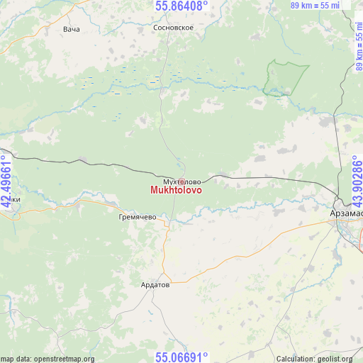
Mukhtolovo GPS coordinates[2]
55° 28' 3.036" North, 43° 11' 59.028" East
| Map corner | latitude | longitude |
|---|---|---|
| Upper-left | 55.86408°, | 42.49661° |
| Center: | 55.46751°, | 43.19973° |
| Lower-right: | 55.06691°, | 43.90286° |
| Map W x H: | 88.6×88.6 km | = 55.1×55.1mi |
| max Lat: | 73.50819° ⇑42.2% North |
| Mukhtolovo: | 55.46751° |
| min Lat: | ⇓57.8% South 41.28413° |
| min Long | Mukhtolovo | max Long |
| -179.12198° | 43.19973° | 179.35046° |
| W 44.1%⇐ | ⇒55.9% E |
Elevation
Elevation of Mukhtolovo is 183 m = 600 ft, and this is 19.6 m = 64 ft below average elevation for this country.
| Max E: |
2518 m = 8261 ft | 34.6% |
| Avg. | 202.6 m = 665 ft | |
| Mukhtolovo | 183 m = 600 ft | |
Min E: |
-28 m = -92 ft | 65.4% |
See also: Russia elevation on elevation.city.
Geographical zone
Mukhtolovo is located in North temperate zone (between Tropic of Cancer and the Arctic Circle). Distance of this North polar circle is 1233.8 km =766.6 mi to North.| Distance of | km | miles | from Mukhtolovo |
|---|---|---|---|
| North Pole | 3839.7 | 2385.9 | to North |
| Arctic Circle | 1233.8 | 766.6 | to North |
| Tropic Cancer | 3561.5 | 2213 | to South |
| Equator | 6167.4 | 3832.2 | to South |


Nearby cities:
15 places around Mukhtolovo: (largest is in red/bold)
• Ardatov
25.9 km =16.1 mi,  194°
194°
• Arzamas
41.2 km =25.6 mi,  101°
101°
• Chernukha
37.8 km =23.5 mi,  67°
67°
• Diveyevo
47.2 km =29.3 mi,  176°
176°
• Gremyachevo
13.7 km =8.5 mi,  232°
232°
• Kulebaki
42.5 km =26.4 mi,  261°
261°
• Pavlovo
56.1 km =34.9 mi,  353°
353°
• Savasleyka
55.4 km =34.4 mi,  269°
269°
• Sosnovskoye
37.6 km =23.4 mi,  356°
356°
• Surovatikha
55 km =34.2 mi,  52°
52°
• Taremskoye
52.2 km =32.4 mi, 349°
• Vacha
46 km =28.6 mi,  324°
324°
• Velet’ma
51.3 km =31.9 mi,  253°
253°
• Vorsma
58.3 km =36.2 mi,  4°
4°
• Vyyezdnoye
38.2 km =23.7 mi, 104°
Sources, notices
• [Note1] Compared only with cities in Russia existing in our database
• [Src1] Map data: © OpenStreetMap contributors (CC-BY-SA)
• [Src2] Other city data from geonames.org with taken over terms of usage.
• [Src3] Geographical zone / Annual Mean Temperature by Robert A. Rohde @ Wikipedia
