Mikhaylovskaya geodata
Mikhaylovskaya (Krasnodarskiy) is a populated place; located in Russia in Europe/Moscow (GMT+3) time zone. With population of 8,050 people, there are 1791 cities with bigger population in this country. Compared to other cities in Russia, 87.4% of cities are located further ↑North; 64.6% of cities are located further →East and 50.2% of cities have higher elevation than Mikhaylovskaya. Note1


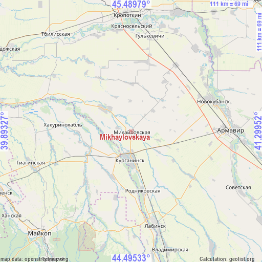
Mikhaylovskaya GPS coordinates[2]
44° 59' 40.992" North, 40° 35' 47.004" East
| Map corner | latitude | longitude |
|---|---|---|
| Upper-left | 45.48979°, | 39.89327° |
| Center: | 44.99472°, | 40.59639° |
| Lower-right: | 44.49533°, | 41.29952° |
| Map W x H: | 110.6×110.6 km | = 68.7×68.7mi |
| max Lat: | 73.50819° ⇑87.4% North |
| Mikhaylovskaya: | 44.99472° |
| min Lat: | ⇓12.6% South 41.28413° |
| min Long | Mikhaylovskaya | max Long |
| -179.12198° | 40.59639° | 179.35046° |
| W 35.4%⇐ | ⇒64.6% E |
Elevation
Elevation of Mikhaylovskaya is 144 m = 472 ft, and this is 58.6 m = 192 ft below average elevation for this country.
| Max E: |
2518 m = 8261 ft | 50.2% |
| Avg. | 202.6 m = 665 ft | |
| Mikhaylovskaya | 144 m = 472 ft | |
Min E: |
-28 m = -92 ft | 49.8% |
See also: Russia elevation on elevation.city.
Geographical zone
Mikhaylovskaya is located in North temperate zone (between Tropic of Cancer and the Arctic Circle). Distance of this Northern Tropic circle is 2397 km =1489.4 mi to South.| Distance of | km | miles | from Mikhaylovskaya |
|---|---|---|---|
| North Pole | 5004.1 | 3109.4 | to North |
| Arctic Circle | 2398.2 | 1490.2 | to North |
| Tropic Cancer | 2397 | 1489.4 | to South |
| Equator | 5002.9 | 3108.7 | to South |


Nearby cities:
15 places around Mikhaylovskaya: (largest is in red/bold)
• Blechepsin
20.8 km =12.9 mi,  201°
201°
• Dondukovskaya
22.3 km =13.9 mi,  235°
235°
• Glubokiy
33.6 km =20.9 mi,  99°
99°
• Konstantinovskaya
20.5 km =12.7 mi,  149°
149°
• Koshekhabl’
12.7 km =7.9 mi,  211°
211°
• Kurganinsk
12.8 km =8 mi,  179°
179°
• Natyrbovo
29.5 km =18.3 mi, 175°
• Novoalekseyevskaya
33 km =20.5 mi,  126°
126°
• Otrado-Kubanskoye
33.7 km =20.9 mi,  34°
34°
• Petropavlovskaya
15 km =9.3 mi,  310°
310°
• Rodnikovskaya
26.2 km =16.3 mi,  167°
167°
• Shovgenovskiy
29.2 km =18.1 mi,  273°
273°
• Sokolovskoye
30 km =18.6 mi,  12°
12°
• Temirgoyevskaya
28.2 km =17.5 mi,  298°
298°
• Yuzhnyy
9.6 km =6 mi,  275°
275°
Sources, notices
• [Note1] Compared only with cities in Russia existing in our database
• [Src1] Map data: © OpenStreetMap contributors (CC-BY-SA)
• [Src2] Other city data from geonames.org with taken over terms of usage.
• [Src3] Geographical zone / Annual Mean Temperature by Robert A. Rohde @ Wikipedia
