Lomintsevskiy geodata
Lomintsevskiy (Tula) is a populated place; located in Russia in Europe/Moscow (GMT+3) time zone. With population of 4,666 people, there are 2798 cities with bigger population in this country. Compared to other cities in Russia, 55.3% of cities are located further ↑North; 80% of cities are located further →East and 63.3% of cities have lower elevation than Lomintsevskiy. Note1


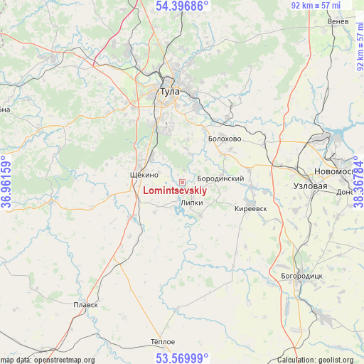
Lomintsevskiy GPS coordinates[2]
53° 59' 7.728" North, 37° 39' 52.956" East
| Map corner | latitude | longitude |
|---|---|---|
| Upper-left | 54.39686°, | 36.96159° |
| Center: | 53.98548°, | 37.66471° |
| Lower-right: | 53.56999°, | 38.36784° |
| Map W x H: | 91.9×91.9 km | = 57.1×57.1mi |
| max Lat: | 73.50819° ⇑55.3% North |
| Lomintsevskiy: | 53.98548° |
| min Lat: | ⇓44.7% South 41.28413° |
| min Long | Lomintsevskiy | max Long |
| -179.12198° | 37.66471° | 179.35046° |
| W 20%⇐ | ⇒80% E |
Elevation
Elevation of Lomintsevskiy is 177 m = 581 ft, and this is 25.6 m = 84 ft below average elevation for this country.
| Max E: |
2518 m = 8261 ft | 36.7% |
| Avg. | 202.6 m = 665 ft | |
| Lomintsevskiy | 177 m = 581 ft | |
Min E: |
-28 m = -92 ft | 63.3% |
See also: Russia elevation on elevation.city.
Geographical zone
Lomintsevskiy is located in North temperate zone (between Tropic of Cancer and the Arctic Circle). Distance of this North polar circle is 1398.6 km =869 mi to North.| Distance of | km | miles | from Lomintsevskiy |
|---|---|---|---|
| North Pole | 4004.4 | 2488.2 | to North |
| Arctic Circle | 1398.6 | 869 | to North |
| Tropic Cancer | 3396.7 | 2110.6 | to South |
| Equator | 6002.6 | 3729.8 | to South |


Nearby cities:
15 places around Lomintsevskiy: (largest is in red/bold)
• Bolokhovo
15.3 km =9.5 mi,  44°
44°
• Borodinskiy
10.1 km =6.3 mi,  81°
81°
• Brusyanka
24.3 km =15.1 mi,  90°
90°
• Dubovka
26.3 km =16.3 mi,  98°
98°
• Kireyevsk
18.2 km =11.3 mi,  108°
108°
• Kosaya Gora
16.8 km =10.4 mi,  332°
332°
• Mendeleyevskiy
17.6 km =10.9 mi,  343°
343°
• Partizan
28.6 km =17.8 mi, 97°
• Pervomayskiy
12.1 km =7.5 mi,  302°
302°
• Priupskiy
9.6 km =6 mi,  151°
151°
• Shchëkino
9.6 km =6 mi,  283°
283°
• Shvartsevskiy
24.3 km =15.1 mi,  60°
60°
• Skuratovskiy
13.5 km =8.4 mi, 342°
• Tula
23.6 km =14.7 mi,  352°
352°
• Yasnaya Polyana
13 km =8.1 mi,  315°
315°
Sources, notices
• [Note1] Compared only with cities in Russia existing in our database
• [Src1] Map data: © OpenStreetMap contributors (CC-BY-SA)
• [Src2] Other city data from geonames.org with taken over terms of usage.
• [Src3] Geographical zone / Annual Mean Temperature by Robert A. Rohde @ Wikipedia
