Levokumka geodata
Levokumka (Stavropol’ Kray) is a populated place; located in Russia in Europe/Moscow (GMT+3) time zone. With population of 5,651 people, there are 2379 cities with bigger population in this country. Compared to other cities in Russia, 90.5% of cities are located further ↑North; 56.1% of cities are located further →East and 83.7% of cities have lower elevation than Levokumka. Note1


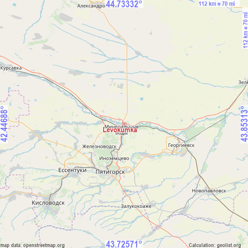
Levokumka GPS coordinates[2]
44° 13' 54.012" North, 43° 9' 0" East
| Map corner | latitude | longitude |
|---|---|---|
| Upper-left | 44.73332°, | 42.44688° |
| Center: | 44.23167°, | 43.15° |
| Lower-right: | 43.72571°, | 43.85313° |
| Map W x H: | 112×112 km | = 69.6×69.6mi |
| max Lat: | 73.50819° ⇑90.5% North |
| Levokumka: | 44.23167° |
| min Lat: | ⇓9.5% South 41.28413° |
| min Long | Levokumka | max Long |
| -179.12198° | 43.15° | 179.35046° |
| W 43.9%⇐ | ⇒56.1% E |
Elevation
Elevation of Levokumka is 297 m = 974 ft, and this is 94.4 m = 310 ft above average elevation for this country.
| Max E: |
2518 m = 8261 ft | 16.3% |
| Levokumka | 297 m 974 ft | |
| Avg. | 202.6 m = 665 ft | |
Min E: |
-28 m = -92 ft | 83.7% |
See also: Russia elevation on elevation.city.
Geographical zone
Levokumka is located in North temperate zone (between Tropic of Cancer and the Arctic Circle). Distance of this Northern Tropic circle is 2312.2 km =1436.7 mi to South.| Distance of | km | miles | from Levokumka |
|---|---|---|---|
| North Pole | 5089 | 3162.2 | to North |
| Arctic Circle | 2483.1 | 1542.9 | to North |
| Tropic Cancer | 2312.2 | 1436.7 | to South |
| Equator | 4918.1 | 3056 | to South |


Nearby cities:
15 places around Levokumka: (largest is in red/bold)
• Aleksandriyskaya
15.6 km =9.7 mi,  91°
91°
• Andzhiyevskiy
5.2 km =3.2 mi,  278°
278°
• Inozemtsevo
16.2 km =10.1 mi,  196°
196°
• Kangly
9.8 km =6.1 mi, 284°
• Konstantinovskaya
20.7 km =12.9 mi,  178°
178°
• Lermontov
19.8 km =12.3 mi,  225°
225°
• Lysogorskaya
17.2 km =10.7 mi,  144°
144°
• Mineralnye Vody
2.7 km =1.7 mi,  206°
206°
• Novoterskiy
10.3 km =6.4 mi, 206°
• Podgornaya
22.5 km =14 mi,  98°
98°
• Podkumskiy
18 km =11.2 mi,  164°
164°
• Pyatigorsk
21.6 km =13.4 mi, 199°
• Vinsady
22.3 km =13.9 mi,  221°
221°
• Zheleznovodsk
14.6 km =9.1 mi, 225°
• Zmeyka
10.2 km =6.3 mi,  193°
193°
Sources, notices
• [Note1] Compared only with cities in Russia existing in our database
• [Src1] Map data: © OpenStreetMap contributors (CC-BY-SA)
• [Src2] Other city data from geonames.org with taken over terms of usage.
• [Src3] Geographical zone / Annual Mean Temperature by Robert A. Rohde @ Wikipedia
