Podgornaya geodata
Podgornaya (Stavropol’ Kray) is a populated place; located in Russia in Europe/Moscow (GMT+3) time zone. With population of 5,336 people, there are 2494 cities with bigger population in this country. Compared to other cities in Russia, 90.7% of cities are located further ↑North; 55% of cities are located further →East and 79.5% of cities have lower elevation than Podgornaya. Note1


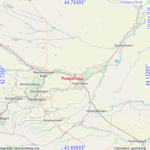
Podgornaya GPS coordinates[2]
44° 12' 11.016" North, 43° 25' 46.992" East
| Map corner | latitude | longitude |
|---|---|---|
| Upper-left | 44.70495°, | 42.7266° |
| Center: | 44.20306°, | 43.42972° |
| Lower-right: | 43.69685°, | 44.13285° |
| Map W x H: | 112.1×112.1 km | = 69.7×69.7mi |
| max Lat: | 73.50819° ⇑90.7% North |
| Podgornaya: | 44.20306° |
| min Lat: | ⇓9.3% South 41.28413° |
| min Long | Podgornaya | max Long |
| -179.12198° | 43.42972° | 179.35046° |
| W 45%⇐ | ⇒55% E |
Elevation
Elevation of Podgornaya is 244 m = 801 ft, and this is 41.4 m = 136 ft above average elevation for this country.
| Max E: |
2518 m = 8261 ft | 20.5% |
| Podgornaya | 244 m 801 ft | |
| Avg. | 202.6 m = 665 ft | |
Min E: |
-28 m = -92 ft | 79.5% |
See also: Russia elevation on elevation.city.
Geographical zone
Podgornaya is located in North temperate zone (between Tropic of Cancer and the Arctic Circle). Distance of this Northern Tropic circle is 2309 km =1434.7 mi to South.| Distance of | km | miles | from Podgornaya |
|---|---|---|---|
| North Pole | 5092.1 | 3164.1 | to North |
| Arctic Circle | 2486.3 | 1544.9 | to North |
| Tropic Cancer | 2309 | 1434.7 | to South |
| Equator | 4914.9 | 3054 | to South |


Nearby cities:
15 places around Podgornaya: (largest is in red/bold)
• Aleksandriyskaya
7.2 km =4.5 mi,  291°
291°
• Andzhiyevskiy
27.7 km =17.2 mi,  278°
278°
• Georgiyevsk
6.5 km =4 mi,  150°
150°
• Georgiyevskaya
11.3 km =7 mi, 153°
• Komsomolets
23.2 km =14.4 mi, 151°
• Krasnokumskoye
6.4 km =4 mi,  115°
115°
• Levokumka
22.5 km =14 mi, 278°
• Lysogorskaya
16.3 km =10.1 mi,  228°
228°
• Mineralnye Vody
23.5 km =14.6 mi,  271°
271°
• Nezlobnaya
9.7 km =6 mi,  192°
192°
• Novoterskiy
27.6 km =17.1 mi,  257°
257°
• Novozavedennoye
17.9 km =11.1 mi,  68°
68°
• Podkumskiy
22.5 km =14 mi, 231°
• Soldato-Aleksandrovskoye
26.9 km =16.7 mi,  75°
75°
• Zmeyka
25.5 km =15.8 mi,  254°
254°
Sources, notices
• [Note1] Compared only with cities in Russia existing in our database
• [Src1] Map data: © OpenStreetMap contributors (CC-BY-SA)
• [Src2] Other city data from geonames.org with taken over terms of usage.
• [Src3] Geographical zone / Annual Mean Temperature by Robert A. Rohde @ Wikipedia
