Leninskiy geodata
Leninskiy (Tula) is a populated place; located in Russia in Europe/Moscow (GMT+3) time zone. With population of 9,834 people, there are 1535 cities with bigger population in this country. Compared to other cities in Russia, 52.8% of cities are located further ↑North; 82.4% of cities are located further →East and 64.3% of cities have lower elevation than Leninskiy. Note1


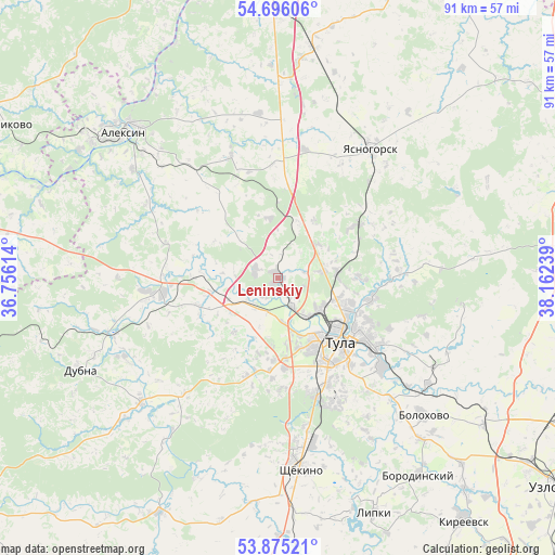
Leninskiy GPS coordinates[2]
54° 17' 15.648" North, 37° 27' 33.336" East
| Map corner | latitude | longitude |
|---|---|---|
| Upper-left | 54.69606°, | 36.75614° |
| Center: | 54.28768°, | 37.45926° |
| Lower-right: | 53.87521°, | 38.16239° |
| Map W x H: | 91.3×91.3 km | = 56.7×56.7mi |
| max Lat: | 73.50819° ⇑52.8% North |
| Leninskiy: | 54.28768° |
| min Lat: | ⇓47.2% South 41.28413° |
| min Long | Leninskiy | max Long |
| -179.12198° | 37.45926° | 179.35046° |
| W 17.6%⇐ | ⇒82.4% E |
Elevation
Elevation of Leninskiy is 180 m = 591 ft, and this is 22.6 m = 74 ft below average elevation for this country.
| Max E: |
2518 m = 8261 ft | 35.7% |
| Avg. | 202.6 m = 665 ft | |
| Leninskiy | 180 m = 591 ft | |
Min E: |
-28 m = -92 ft | 64.3% |
See also: Russia elevation on elevation.city.
Geographical zone
Leninskiy is located in North temperate zone (between Tropic of Cancer and the Arctic Circle). Distance of this North polar circle is 1364.9 km =848.1 mi to North.| Distance of | km | miles | from Leninskiy |
|---|---|---|---|
| North Pole | 3970.8 | 2467.3 | to North |
| Arctic Circle | 1364.9 | 848.1 | to North |
| Tropic Cancer | 3430.3 | 2131.5 | to South |
| Equator | 6036.2 | 3750.7 | to South |


Nearby cities:
15 places around Leninskiy: (largest is in red/bold)
• Aleksin
35 km =21.7 mi,  313°
313°
• Barsuki
3.1 km =1.9 mi,  143°
143°
• Bolokhovo
33.1 km =20.6 mi,  133°
133°
• Gorelki
10.4 km =6.5 mi,  109°
109°
• Kosaya Gora
19.6 km =12.2 mi,  163°
163°
• Mendeleyevskiy
18.7 km =11.6 mi,  153°
153°
• Novogurovskiy
21.5 km =13.4 mi,  338°
338°
• Pervomayskiy
27.2 km =16.9 mi,  173°
173°
• Revyakino
15.7 km =9.8 mi,  56°
56°
• Rozhdestvenskiy
7.3 km =4.5 mi,  82°
82°
• Shchëkino
31.7 km =19.7 mi, 172°
• Skuratovskiy
22.7 km =14.1 mi, 155°
• Tula
14.5 km =9 mi, 134°
• Yasnaya Polyana
24.7 km =15.3 mi, 170°
• Yasnogorsk
26.5 km =16.5 mi,  35°
35°
Sources, notices
• [Note1] Compared only with cities in Russia existing in our database
• [Src1] Map data: © OpenStreetMap contributors (CC-BY-SA)
• [Src2] Other city data from geonames.org with taken over terms of usage.
• [Src3] Geographical zone / Annual Mean Temperature by Robert A. Rohde @ Wikipedia
