Kytlym geodata
Kytlym (Sverdlovsk) is a populated place; located in Russia in Asia/Yekaterinburg (GMT+5) time zone. With population of 872 people, there are 4720 cities with bigger population in this country. Compared to other cities in Russia, 87.9% of cities are located further ↓South; 70.5% of cities are located further ←West and 87.8% of cities have lower elevation than Kytlym. Note1


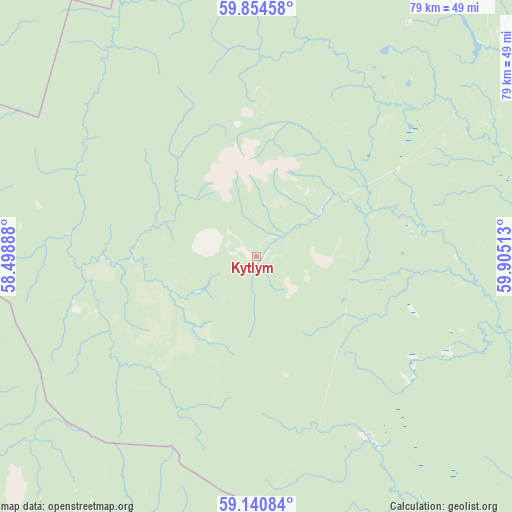
Kytlym GPS coordinates[2]
59° 29' 58.56" North, 59° 12' 7.2" East
| Map corner | latitude | longitude |
|---|---|---|
| Upper-left | 59.85458°, | 58.49888° |
| Center: | 59.4996°, | 59.202° |
| Lower-right: | 59.14084°, | 59.90513° |
| Map W x H: | 79.4×79.4 km | = 49.3×49.3mi |
| max Lat: | 73.50819° ⇑12.1% North |
| Kytlym: | 59.4996° |
| min Lat: | ⇓87.9% South 41.28413° |
| min Long | Kytlym | max Long |
| -179.12198° | 59.202° | 179.35046° |
| W 70.5%⇐ | ⇒29.5% E |
Elevation
Elevation of Kytlym is 392 m = 1286 ft, and this is 189.4 m = 621 ft above average elevation for this country.
| Max E: |
2518 m = 8261 ft | 12.2% |
| Kytlym | 392 m 1286 ft | |
| Avg. | 202.6 m = 665 ft | |
Min E: |
-28 m = -92 ft | 87.8% |
See also: Russia elevation on elevation.city.
Geographical zone
Kytlym is located in North temperate zone (between Tropic of Cancer and the Arctic Circle). Distance of this North polar circle is 785.4 km =488 mi to North.| Distance of | km | miles | from Kytlym |
|---|---|---|---|
| North Pole | 3391.3 | 2107.3 | to North |
| Arctic Circle | 785.4 | 488 | to North |
| Tropic Cancer | 4009.8 | 2491.6 | to South |
| Equator | 6615.7 | 4110.8 | to South |


Nearby cities:
15 places around Kytlym: (largest is in red/bold)
• Is
84.1 km =52.3 mi,  159°
159°
• Kachkanar
90.3 km =56.1 mi,  169°
169°
• Karpinsk
53.8 km =33.4 mi,  56°
56°
• Krasnotur’insk
63.9 km =39.7 mi, 62°
• Lobva
82.4 km =51.2 mi,  115°
115°
• Medvedka
84.6 km =52.6 mi,  183°
183°
• Pavda
33.4 km =20.8 mi,  147°
147°
• Rudnichnyy
65.1 km =40.5 mi,  69°
69°
• Serov
78.4 km =48.7 mi,  81°
81°
• Severnyy-Kospashskiy
91.5 km =56.9 mi,  240°
240°
• Severoural’sk
83.9 km =52.1 mi,  29°
29°
• Tretiy Severnyy
89.5 km =55.6 mi, 28°
• Valerianovsk
84.6 km =52.6 mi, 166°
• Volchansk
69.3 km =43.1 mi,  45°
45°
• Vorontsovka
60.9 km =37.8 mi, 73°
Sources, notices
• [Note1] Compared only with cities in Russia existing in our database
• [Src1] Map data: © OpenStreetMap contributors (CC-BY-SA)
• [Src2] Other city data from geonames.org with taken over terms of usage.
• [Src3] Geographical zone / Annual Mean Temperature by Robert A. Rohde @ Wikipedia
