Kruglolesskoye geodata
Kruglolesskoye (Stavropol’ Kray) is a populated place; located in Russia in Europe/Moscow (GMT+3) time zone. With population of 3,249 people, there are 3567 cities with bigger population in this country. Compared to other cities in Russia, 88.9% of cities are located further ↑North; 57.4% of cities are located further →East and 90.1% of cities have lower elevation than Kruglolesskoye. Note1


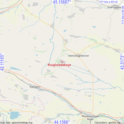
Kruglolesskoye GPS coordinates[2]
44° 39' 32.004" North, 42° 48' 51.012" East
| Map corner | latitude | longitude |
|---|---|---|
| Upper-left | 45.15687°, | 42.11105° |
| Center: | 44.65889°, | 42.81417° |
| Lower-right: | 44.1566°, | 43.5173° |
| Map W x H: | 111.2×111.2 km | = 69.1×69.1mi |
| max Lat: | 73.50819° ⇑88.9% North |
| Kruglolesskoye: | 44.65889° |
| min Lat: | ⇓11.1% South 41.28413° |
| min Long | Kruglolesskoye | max Long |
| -179.12198° | 42.81417° | 179.35046° |
| W 42.6%⇐ | ⇒57.4% E |
Elevation
Elevation of Kruglolesskoye is 452 m = 1483 ft, and this is 249.4 m = 818 ft above average elevation for this country.
| Max E: |
2518 m = 8261 ft | 9.9% |
| Kruglolesskoye | 452 m 1483 ft | |
| Avg. | 202.6 m = 665 ft | |
Min E: |
-28 m = -92 ft | 90.1% |
See also: Russia elevation on elevation.city.
Geographical zone
Kruglolesskoye is located in North temperate zone (between Tropic of Cancer and the Arctic Circle). Distance of this Northern Tropic circle is 2359.7 km =1466.2 mi to South.| Distance of | km | miles | from Kruglolesskoye |
|---|---|---|---|
| North Pole | 5041.5 | 3132.6 | to North |
| Arctic Circle | 2435.6 | 1513.4 | to North |
| Tropic Cancer | 2359.7 | 1466.2 | to South |
| Equator | 4965.6 | 3085.5 | to South |


Nearby cities:
15 places around Kruglolesskoye: (largest is in red/bold)
• Aleksandrovskoye
16 km =9.9 mi,  67°
67°
• Andzhiyevskiy
51.4 km =31.9 mi,  155°
155°
• Beshpagir
52.9 km =32.9 mi,  319°
319°
• Gofitskoye
50.2 km =31.2 mi,  21°
21°
• Grazhdanskoye
47.8 km =29.7 mi,  184°
184°
• Grecheskoye
29.7 km =18.5 mi,  148°
148°
• Kalinovskoye
25.6 km =15.9 mi,  27°
27°
• Kangly
48.1 km =29.9 mi, 159°
• Kursavka
33 km =20.5 mi,  227°
227°
• Nagutskoye
24.7 km =15.3 mi,  168°
168°
• Novoselitskoye
50.3 km =31.3 mi,  78°
78°
• Severnoye
19.6 km =12.2 mi,  10°
10°
• Soluno-Dmitriyevskoye
28.9 km =18 mi,  194°
194°
• Udarnyy
42.3 km =26.3 mi,  215°
215°
• Vysotskoye
41.4 km =25.7 mi, 10°
Sources, notices
• [Note1] Compared only with cities in Russia existing in our database
• [Src1] Map data: © OpenStreetMap contributors (CC-BY-SA)
• [Src2] Other city data from geonames.org with taken over terms of usage.
• [Src3] Geographical zone / Annual Mean Temperature by Robert A. Rohde @ Wikipedia
