Korocha geodata
Korocha (Belgorod Oblast) is a populated place; located in Russia in Europe/Moscow (GMT+3) time zone. With population of 5,890 people, there are 2299 cities with bigger population in this country. Compared to other cities in Russia, 75.5% of cities are located further ↑North; 84% of cities are located further →East and 69.2% of cities have lower elevation than Korocha. Note1


Korocha GPS coordinates[2]
50° 48' 47.52" North, 37° 11' 9.528" East
| Map corner | latitude | longitude |
|---|---|---|
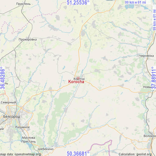
| Upper-left | 51.25536°, | 36.48286° |
| Center: | 50.8132°, | 37.18598° |
| Lower-right: | 50.36681°, | 37.88911° |
| Map W x H: | 98.8×98.8 km | = 61.4×61.4mi |
| max Lat: | 73.50819° ⇑75.5% North |
| Korocha: | 50.8132° |
| min Lat: | ⇓24.5% South 41.28413° |
| min Long | Korocha | max Long |
| -179.12198° | 37.18598° | 179.35046° |
| W 16%⇐ | ⇒84% E |
Elevation
Elevation of Korocha is 195 m = 640 ft, and this is 7.6 m = 25 ft below average elevation for this country.
| Max E: |
2518 m = 8261 ft | 30.8% |
| Avg. | 202.6 m = 665 ft | |
| Korocha | 195 m = 640 ft | |
Min E: |
-28 m = -92 ft | 69.2% |
See also: Russia elevation on elevation.city.
Geographical zone
Korocha is located in North temperate zone (between Tropic of Cancer and the Arctic Circle). Distance of this North polar circle is 1751.3 km =1088.2 mi to North.| Distance of | km | miles | from Korocha |
|---|---|---|---|
| North Pole | 4357.2 | 2707.4 | to North |
| Arctic Circle | 1751.3 | 1088.2 | to North |
| Tropic Cancer | 3044 | 1891.5 | to South |
| Equator | 5649.9 | 3510.7 | to South |


Nearby cities:
15 places around Korocha: (largest is in red/bold)
• Bekhteyevka
2.3 km =1.4 mi,  105°
105°
• Belgorod
48.2 km =30 mi,  242°
242°
• Chernyanka
45.8 km =28.5 mi,  71°
71°
• Gorod Shebekino
48 km =29.8 mi,  203°
203°
• Gubkin
57.8 km =35.9 mi,  25°
25°
• Maslova Pristan’
51.4 km =31.9 mi,  219°
219°
• Novaya Tavolzhanka
57.2 km =35.5 mi,  206°
206°
• Novyy Oskol
48 km =29.8 mi,  96°
96°
• Prokhorovka
40.4 km =25.1 mi,  308°
308°
• Razumnoye
47 km =29.2 mi,  228°
228°
• Severnyy
47 km =29.2 mi,  251°
251°
• Shebekino
48.8 km =30.3 mi, 203°
• Skorodnoye
28.8 km =17.9 mi,  5°
5°
• Stroitel’
49.5 km =30.8 mi,  266°
266°
• Yakovlevo
52.1 km =32.4 mi,  275°
275°
Sources, notices
• [Note1] Compared only with cities in Russia existing in our database
• [Src1] Map data: © OpenStreetMap contributors (CC-BY-SA)
• [Src2] Other city data from geonames.org with taken over terms of usage.
• [Src3] Geographical zone / Annual Mean Temperature by Robert A. Rohde @ Wikipedia
