Belgorod geodata
Belgorod (Belgorod Oblast) is a seat of a first-order administrative division; located in Russia in Europe/Moscow (GMT+3) time zone. With population of 345,289 people, there are 51 cities with bigger population in this country. Compared to other cities in Russia, 76.3% of cities are located further ↑North; 86% of cities are located further →East and 61.6% of cities have lower elevation than Belgorod. Note1


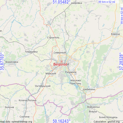
Belgorod GPS coordinates[2]
50° 36' 38.664" North, 36° 34' 48.54" East
| Map corner | latitude | longitude |
|---|---|---|
| Upper-left | 51.05482°, | 35.87703° |
| Center: | 50.61074°, | 36.58015° |
| Lower-right: | 50.16243°, | 37.28328° |
| Map W x H: | 99.2×99.2 km | = 61.6×61.6mi |
| max Lat: | 73.50819° ⇑76.3% North |
| Belgorod: | 50.61074° |
| min Lat: | ⇓23.7% South 41.28413° |
| min Long | Belgorod | max Long |
| -179.12198° | 36.58015° | 179.35046° |
| W 14%⇐ | ⇒86% E |
Elevation
Elevation of Belgorod is 173 m = 568 ft, and this is 29.6 m = 97 ft below average elevation for this country.
| Max E: |
2518 m = 8261 ft | 38.4% |
| Avg. | 202.6 m = 665 ft | |
| Belgorod | 173 m = 568 ft | |
Min E: |
-28 m = -92 ft | 61.6% |
See also: Belgorod elevation on elevation.city.
Geographical zone
Belgorod is located in North temperate zone (between Tropic of Cancer and the Arctic Circle). Distance of this North polar circle is 1773.8 km =1102.2 mi to North.| Distance of | km | miles | from Belgorod |
|---|---|---|---|
| North Pole | 4379.7 | 2721.4 | to North |
| Arctic Circle | 1773.8 | 1102.2 | to North |
| Tropic Cancer | 3021.5 | 1877.5 | to South |
| Equator | 5627.4 | 3496.7 | to South |


Nearby cities:
15 places around Belgorod: (largest is in red/bold)
• Bekhteyevka
50 km =31.1 mi,  64°
64°
• Bessonovka
21.8 km =13.5 mi,  244°
244°
• Borisovka
39.9 km =24.8 mi,  268°
268°
• Gorod Shebekino
32.1 km =19.9 mi,  132°
132°
• Korocha
48.2 km =30 mi, 62°
• Maslova Pristan’
19.7 km =12.2 mi,  149°
149°
• Mayskiy
13.2 km =8.2 mi,  220°
220°
• Novaya Tavolzhanka
33.8 km =21 mi, 148°
• Prokhorovka
48.6 km =30.2 mi,  12°
12°
• Razumnoye
11.2 km =7 mi,  139°
139°
• Severnyy
7.6 km =4.7 mi,  345°
345°
• Shebekino
32.5 km =20.2 mi, 133°
• Stroitel’
20.6 km =12.8 mi,  340°
340°
• Tomarovka
25.8 km =16 mi,  288°
288°
• Yakovlevo
29.3 km =18.2 mi, 341°
Sources, notices
• [Note1] Compared only with cities in Russia existing in our database
• [Src1] Map data: © OpenStreetMap contributors (CC-BY-SA)
• [Src2] Other city data from geonames.org with taken over terms of usage.
• [Src3] Geographical zone / Annual Mean Temperature by Robert A. Rohde @ Wikipedia
