Konstantinovskiy geodata
Konstantinovskiy (Jaroslavl) is a populated place; located in Russia in Europe/Moscow (GMT+3) time zone. With population of 5,718 people, there are 2358 cities with bigger population in this country. Compared to other cities in Russia, 81.7% of cities are located further ↓South; 69.6% of cities are located further →East and 65.3% of cities have higher elevation than Konstantinovskiy. Note1


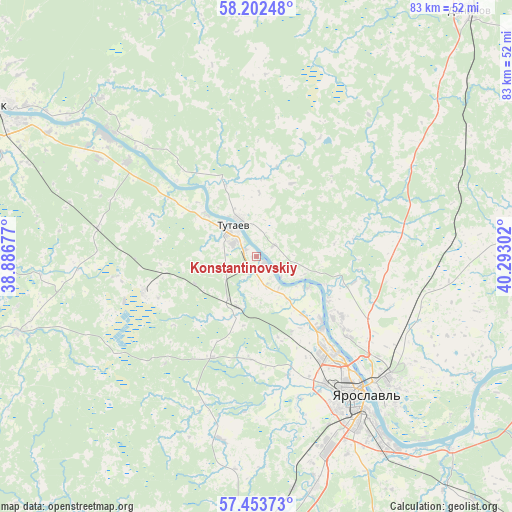
Konstantinovskiy GPS coordinates[2]
57° 49' 48.18" North, 39° 35' 23.604" East
| Map corner | latitude | longitude |
|---|---|---|
| Upper-left | 58.20248°, | 38.88677° |
| Center: | 57.83005°, | 39.58989° |
| Lower-right: | 57.45373°, | 40.29302° |
| Map W x H: | 83.3×83.2 km | = 51.8×51.7mi |
| max Lat: | 73.50819° ⇑18.3% North |
| Konstantinovskiy: | 57.83005° |
| min Lat: | ⇓81.7% South 41.28413° |
| min Long | Konstantinovski | max Long |
| -179.12198° | 39.58989° | 179.35046° |
| W 30.4%⇐ | ⇒69.6% E |
Elevation
Elevation of Konstantinovskiy is 113 m = 371 ft, and this is 89.6 m = 294 ft below average elevation for this country.
| Max E: |
2518 m = 8261 ft | 65.3% |
| Avg. | 202.6 m = 665 ft | |
| Konstantinovskiy | 113 m = 371 ft | |
Min E: |
-28 m = -92 ft | 34.7% |
See also: Russia elevation on elevation.city.
Geographical zone
Konstantinovskiy is located in North temperate zone (between Tropic of Cancer and the Arctic Circle). Distance of this North polar circle is 971.1 km =603.4 mi to North.| Distance of | km | miles | from Konstantinovskiy |
|---|---|---|---|
| North Pole | 3577 | 2222.6 | to North |
| Arctic Circle | 971.1 | 603.4 | to North |
| Tropic Cancer | 3824.2 | 2376.2 | to South |
| Equator | 6430.1 | 3995.5 | to South |


Nearby cities:
15 places around Konstantinovskiy: (largest is in red/bold)
• Bol’shoye Selo
40.9 km =25.4 mi,  252°
252°
• Burmakino
60 km =37.3 mi,  140°
140°
• Danilov
52.8 km =32.8 mi,  40°
40°
• Krasnyy Profintern
51 km =31.7 mi,  100°
100°
• Krasnyye Tkachi
38.8 km =24.1 mi,  165°
165°
• Kurba
30.4 km =18.9 mi,  190°
190°
• Levashevo
59.2 km =36.8 mi,  110°
110°
• Nagornyy
33.3 km =20.7 mi,  153°
153°
• Nekrasovskoye
49.1 km =30.5 mi, 110°
• Pesochnoye
31.3 km =19.4 mi,  308°
308°
• Rybinsk
50.1 km =31.1 mi,  298°
298°
• Semibratovo
58.5 km =36.4 mi,  183°
183°
• Tunoshna
44.8 km =27.8 mi,  134°
134°
• Tutayev
6.8 km =4.2 mi,  334°
334°
• Yaroslavl
27.9 km =17.3 mi, 142°
Sources, notices
• [Note1] Compared only with cities in Russia existing in our database
• [Src1] Map data: © OpenStreetMap contributors (CC-BY-SA)
• [Src2] Other city data from geonames.org with taken over terms of usage.
• [Src3] Geographical zone / Annual Mean Temperature by Robert A. Rohde @ Wikipedia
