Kirillov geodata
Kirillov (Vologda) is a seat of a second-order administrative division; located in Russia in Europe/Moscow (GMT+3) time zone. With population of 7,468 people, there are 1907 cities with bigger population in this country. Compared to other cities in Russia, 89.4% of cities are located further ↓South; 75% of cities are located further →East and 59.2% of cities have higher elevation than Kirillov. Note1


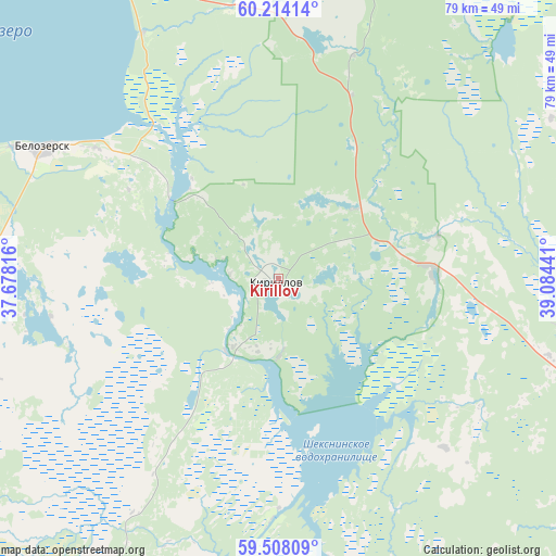
Kirillov GPS coordinates[2]
59° 51' 46.764" North, 38° 22' 52.608" East
| Map corner | latitude | longitude |
|---|---|---|
| Upper-left | 60.21414°, | 37.67816° |
| Center: | 59.86299°, | 38.38128° |
| Lower-right: | 59.50809°, | 39.08441° |
| Map W x H: | 78.5×78.5 km | = 48.8×48.8mi |
| max Lat: | 73.50819° ⇑10.6% North |
| Kirillov: | 59.86299° |
| min Lat: | ⇓89.4% South 41.28413° |
| min Long | Kirillov | max Long |
| -179.12198° | 38.38128° | 179.35046° |
| W 25%⇐ | ⇒75% E |
Elevation
Elevation of Kirillov is 126 m = 413 ft, and this is 76.6 m = 251 ft below average elevation for this country.
| Max E: |
2518 m = 8261 ft | 59.2% |
| Avg. | 202.6 m = 665 ft | |
| Kirillov | 126 m = 413 ft | |
Min E: |
-28 m = -92 ft | 40.8% |
See also: Russia elevation on elevation.city.
Geographical zone
Kirillov is located in North temperate zone (between Tropic of Cancer and the Arctic Circle). Distance of this North polar circle is 745 km =462.9 mi to North.| Distance of | km | miles | from Kirillov |
|---|---|---|---|
| North Pole | 3350.9 | 2082.2 | to North |
| Arctic Circle | 745 | 462.9 | to North |
| Tropic Cancer | 4050.2 | 2516.7 | to South |
| Equator | 6656.1 | 4135.9 | to South |


Nearby cities:
15 places around Kirillov: (largest is in red/bold)
• Belozërsk
36.8 km =22.9 mi,  300°
300°
• Chebsara
78 km =48.5 mi,  160°
160°
• Cherepovets
85.6 km =53.2 mi,  198°
198°
• Ferapontovo
14.5 km =9 mi,  45°
45°
• Goritsy
6.8 km =4.2 mi,  276°
276°
• Khokhlovo
96.8 km =60.1 mi,  214°
214°
• Kuzino
10.4 km =6.5 mi, 202°
• Lipin Bor
49.8 km =30.9 mi,  333°
333°
• Molochnoye
96.8 km =60.1 mi,  131°
131°
• Nelazskoye
85.8 km =53.3 mi, 209°
• Sheksna
73 km =45.4 mi,  174°
174°
• Suda
91.6 km =56.9 mi, 210°
• Tonshalovo
78.2 km =48.6 mi, 198°
• Ust’ye
80.2 km =49.8 mi,  108°
108°
• Zubovo
93.1 km =57.8 mi, 302°
Sources, notices
• [Note1] Compared only with cities in Russia existing in our database
• [Src1] Map data: © OpenStreetMap contributors (CC-BY-SA)
• [Src2] Other city data from geonames.org with taken over terms of usage.
• [Src3] Geographical zone / Annual Mean Temperature by Robert A. Rohde @ Wikipedia
