Kemlya geodata
Kemlya (Mordoviya Republic) is a populated place; located in Russia in Europe/Moscow (GMT+3) time zone. With population of 4,761 people, there are 2755 cities with bigger population in this country. Compared to other cities in Russia, 50.4% of cities are located further ↓South; 50.8% of cities are located further ←West and 59.6% of cities have higher elevation than Kemlya. Note1


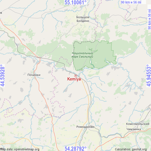
Kemlya GPS coordinates[2]
54° 41' 46.68" North, 45° 14' 32.64" East
| Map corner | latitude | longitude |
|---|---|---|
| Upper-left | 55.10061°, | 44.53928° |
| Center: | 54.6963°, | 45.2424° |
| Lower-right: | 54.28792°, | 45.94553° |
| Map W x H: | 90.4×90.4 km | = 56.2×56.2mi |
| max Lat: | 73.50819° ⇑49.6% North |
| Kemlya: | 54.6963° |
| min Lat: | ⇓50.4% South 41.28413° |
| min Long | Kemlya | max Long |
| -179.12198° | 45.2424° | 179.35046° |
| W 50.8%⇐ | ⇒49.2% E |
Elevation
Elevation of Kemlya is 125 m = 410 ft, and this is 77.6 m = 255 ft below average elevation for this country.
| Max E: |
2518 m = 8261 ft | 59.6% |
| Avg. | 202.6 m = 665 ft | |
| Kemlya | 125 m = 410 ft | |
Min E: |
-28 m = -92 ft | 40.4% |
See also: Russia elevation on elevation.city.
Geographical zone
Kemlya is located in North temperate zone (between Tropic of Cancer and the Arctic Circle). Distance of this North polar circle is 1319.5 km =819.9 mi to North.| Distance of | km | miles | from Kemlya |
|---|---|---|---|
| North Pole | 3925.4 | 2439.1 | to North |
| Arctic Circle | 1319.5 | 819.9 | to North |
| Tropic Cancer | 3475.7 | 2159.7 | to South |
| Equator | 6081.7 | 3779 | to South |


Nearby cities:
15 places around Kemlya: (largest is in red/bold)
• Ardatov
66.1 km =41.1 mi,  75°
75°
• Atemar
58.3 km =36.2 mi,  169°
169°
• Atyashevo
55.2 km =34.3 mi,  105°
105°
• Bol’shoye Boldino
34.7 km =21.6 mi,  7°
7°
• Chamzinka
47.9 km =29.8 mi,  133°
133°
• Gagino
61 km =37.9 mi,  347°
347°
• Imeni Stepana Razina
64.5 km =40.1 mi,  289°
289°
• Lukhovka
60.9 km =37.8 mi,  179°
179°
• Lukoyanov
61.2 km =38 mi,  307°
307°
• Lyambir’
46.7 km =29 mi,  189°
189°
• Nikolayevka
61.6 km =38.3 mi, 185°
• Pochinki
24.1 km =15 mi,  270°
270°
• Romodanovo
30.4 km =18.9 mi, 169°
• Saransk
57.2 km =35.5 mi, 184°
• Staraya Terizmorga
66.8 km =41.5 mi,  223°
223°
Sources, notices
• [Note1] Compared only with cities in Russia existing in our database
• [Src1] Map data: © OpenStreetMap contributors (CC-BY-SA)
• [Src2] Other city data from geonames.org with taken over terms of usage.
• [Src3] Geographical zone / Annual Mean Temperature by Robert A. Rohde @ Wikipedia
