Lukoyanov geodata
Lukoyanov (Nizhny Novgorod Oblast) is a populated place; located in Russia in Europe/Moscow (GMT+3) time zone. With population of 12,913 people, there are 1213 cities with bigger population in this country. Compared to other cities in Russia, 53.6% of cities are located further ↓South; 51.7% of cities are located further →East and 62.1% of cities have lower elevation than Lukoyanov. Note1


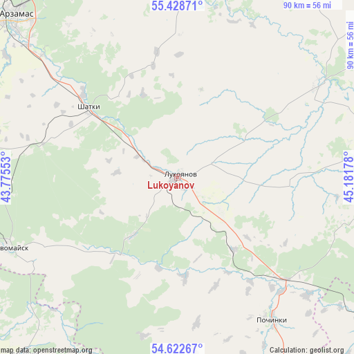
Lukoyanov GPS coordinates[2]
55° 1' 39.792" North, 44° 28' 43.14" East
| Map corner | latitude | longitude |
|---|---|---|
| Upper-left | 55.42871°, | 43.77553° |
| Center: | 55.02772°, | 44.47865° |
| Lower-right: | 54.62267°, | 45.18178° |
| Map W x H: | 89.6×89.6 km | = 55.7×55.7mi |
| max Lat: | 73.50819° ⇑46.4% North |
| Lukoyanov: | 55.02772° |
| min Lat: | ⇓53.6% South 41.28413° |
| min Long | Lukoyanov | max Long |
| -179.12198° | 44.47865° | 179.35046° |
| W 48.3%⇐ | ⇒51.7% E |
Elevation
Elevation of Lukoyanov is 174 m = 571 ft, and this is 28.6 m = 94 ft below average elevation for this country.
| Max E: |
2518 m = 8261 ft | 37.9% |
| Avg. | 202.6 m = 665 ft | |
| Lukoyanov | 174 m = 571 ft | |
Min E: |
-28 m = -92 ft | 62.1% |
See also: Russia elevation on elevation.city.
Geographical zone
Lukoyanov is located in North temperate zone (between Tropic of Cancer and the Arctic Circle). Distance of this North polar circle is 1282.7 km =797 mi to North.| Distance of | km | miles | from Lukoyanov |
|---|---|---|---|
| North Pole | 3888.6 | 2416.3 | to North |
| Arctic Circle | 1282.7 | 797 | to North |
| Tropic Cancer | 3512.6 | 2182.6 | to South |
| Equator | 6118.5 | 3801.9 | to South |


Nearby cities:
15 places around Lukoyanov: (largest is in red/bold)
• Arzamas
57.5 km =35.7 mi,  315°
315°
• Bol’shoye Boldino
53.3 km =33.1 mi,  92°
92°
• Buturlino
65.5 km =40.7 mi,  23°
23°
• Gagino
41.9 km =26 mi,  57°
57°
• Imeni Stepana Razina
19 km =11.8 mi,  217°
217°
• Kemlya
61.2 km =38 mi,  127°
127°
• Lesogorsk
35.5 km =22.1 mi,  282°
282°
• Perevoz
63.3 km =39.3 mi,  3°
3°
• Pervomaysk
46.6 km =29 mi,  247°
247°
• Pochinki
44.2 km =27.5 mi,  145°
145°
• Sarov
74.4 km =46.2 mi,  262°
262°
• Satis
42.3 km =26.3 mi,  269°
269°
• Shatki
28.8 km =17.9 mi,  308°
308°
• Vad
58.4 km =36.3 mi,  343°
343°
• Vyyezdnoye
59 km =36.7 mi, 311°
Sources, notices
• [Note1] Compared only with cities in Russia existing in our database
• [Src1] Map data: © OpenStreetMap contributors (CC-BY-SA)
• [Src2] Other city data from geonames.org with taken over terms of usage.
• [Src3] Geographical zone / Annual Mean Temperature by Robert A. Rohde @ Wikipedia
