Chamzinka geodata
Chamzinka (Mordoviya Republic) is a populated place; located in Russia in Europe/Moscow (GMT+3) time zone. With population of 9,500 people, there are 1593 cities with bigger population in this country. Compared to other cities in Russia, 52% of cities are located further ↑North; 52.3% of cities are located further ←West and 75% of cities have lower elevation than Chamzinka. Note1


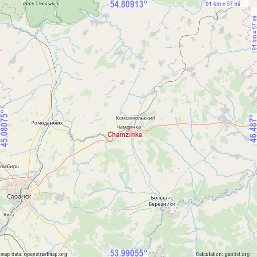
Chamzinka GPS coordinates[2]
54° 24' 6.768" North, 45° 47' 1.932" East
| Map corner | latitude | longitude |
|---|---|---|
| Upper-left | 54.80913°, | 45.08075° |
| Center: | 54.40188°, | 45.78387° |
| Lower-right: | 53.99055°, | 46.487° |
| Map W x H: | 91×91 km | = 56.5×56.5mi |
| max Lat: | 73.50819° ⇑52% North |
| Chamzinka: | 54.40188° |
| min Lat: | ⇓48% South 41.28413° |
| min Long | Chamzinka | max Long |
| -179.12198° | 45.78387° | 179.35046° |
| W 52.3%⇐ | ⇒47.7% E |
Elevation
Elevation of Chamzinka is 217 m = 712 ft, and this is 14.4 m = 47 ft above average elevation for this country.
| Max E: |
2518 m = 8261 ft | 25% |
| Chamzinka | 217 m 712 ft | |
| Avg. | 202.6 m = 665 ft | |
Min E: |
-28 m = -92 ft | 75% |
See also: Russia elevation on elevation.city.
Geographical zone
Chamzinka is located in North temperate zone (between Tropic of Cancer and the Arctic Circle). Distance of this North polar circle is 1352.3 km =840.3 mi to North.| Distance of | km | miles | from Chamzinka |
|---|---|---|---|
| North Pole | 3958.1 | 2459.4 | to North |
| Arctic Circle | 1352.3 | 840.3 | to North |
| Tropic Cancer | 3443 | 2139.4 | to South |
| Equator | 6048.9 | 3758.6 | to South |


Nearby cities:
15 places around Chamzinka: (largest is in red/bold)
• Ardatov
57.6 km =35.8 mi,  30°
30°
• Atemar
34.6 km =21.5 mi,  224°
224°
• Atyashevo
25.8 km =16 mi,  45°
45°
• Kemlya
47.9 km =29.8 mi,  313°
313°
• Kochkurovo
47.1 km =29.3 mi,  210°
210°
• Lukhovka
44.3 km =27.5 mi,  230°
230°
• Lyambir’
44.8 km =27.8 mi,  252°
252°
• Nikolayevka
50.4 km =31.3 mi,  235°
235°
• Romodanovo
29.5 km =18.3 mi,  275°
275°
• Ruzayevka
65.9 km =40.9 mi, 235°
• Saransk
46.4 km =28.8 mi, 238°
• Sura
57.2 km =35.5 mi,  182°
182°
• Surskoye
61.3 km =38.1 mi,  81°
81°
• Turgenevo
60.6 km =37.7 mi,  35°
35°
• Zykovo
58.6 km =36.4 mi, 230°
Sources, notices
• [Note1] Compared only with cities in Russia existing in our database
• [Src1] Map data: © OpenStreetMap contributors (CC-BY-SA)
• [Src2] Other city data from geonames.org with taken over terms of usage.
• [Src3] Geographical zone / Annual Mean Temperature by Robert A. Rohde @ Wikipedia
