Karabanovo geodata
Karabanovo (Vladimir) is a populated place; located in Russia in Europe/Moscow (GMT+3) time zone. With population of 15,615 people, there are 1056 cities with bigger population in this country. Compared to other cities in Russia, 70.8% of cities are located further ↓South; 73.5% of cities are located further →East and 61.6% of cities have lower elevation than Karabanovo. Note1


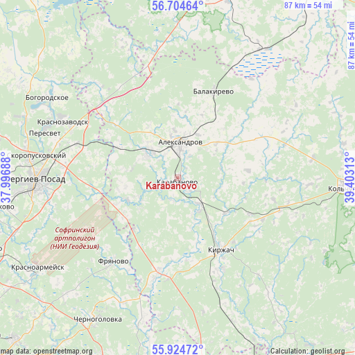
Karabanovo GPS coordinates[2]
56° 19' 0.012" North, 38° 42' 0" East
| Map corner | latitude | longitude |
|---|---|---|
| Upper-left | 56.70464°, | 37.99688° |
| Center: | 56.31667°, | 38.7° |
| Lower-right: | 55.92472°, | 39.40313° |
| Map W x H: | 86.7×86.7 km | = 53.9×53.9mi |
| max Lat: | 73.50819° ⇑29.2% North |
| Karabanovo: | 56.31667° |
| min Lat: | ⇓70.8% South 41.28413° |
| min Long | Karabanovo | max Long |
| -179.12198° | 38.7° | 179.35046° |
| W 26.5%⇐ | ⇒73.5% E |
Elevation
Elevation of Karabanovo is 173 m = 568 ft, and this is 29.6 m = 97 ft below average elevation for this country.
| Max E: |
2518 m = 8261 ft | 38.4% |
| Avg. | 202.6 m = 665 ft | |
| Karabanovo | 173 m = 568 ft | |
Min E: |
-28 m = -92 ft | 61.6% |
See also: Russia elevation on elevation.city.
Geographical zone
Karabanovo is located in North temperate zone (between Tropic of Cancer and the Arctic Circle). Distance of this North polar circle is 1139.3 km =707.9 mi to North.| Distance of | km | miles | from Karabanovo |
|---|---|---|---|
| North Pole | 3745.2 | 2327.2 | to North |
| Arctic Circle | 1139.3 | 707.9 | to North |
| Tropic Cancer | 3655.9 | 2271.7 | to South |
| Equator | 6261.8 | 3890.9 | to South |


Nearby cities:
15 places around Karabanovo: (largest is in red/bold)
• Aleksandrov
8.8 km =5.5 mi,  4°
4°
• Arsaki
15.3 km =9.5 mi,  299°
299°
• Balakirevo
22.8 km =14.2 mi,  22°
22°
• Fryanovo
25.6 km =15.9 mi,  217°
217°
• Kirzhach
20.6 km =12.8 mi,  152°
152°
• Krasnozavodsk
33.2 km =20.6 mi, 296°
• Krasnyy Oktyabr’
25 km =15.5 mi, 152°
• Mukhanovo
31.2 km =19.4 mi,  310°
310°
• Noginsk-9
30.4 km =18.9 mi,  203°
203°
• Novoye
31.8 km =19.8 mi,  352°
352°
• Semenkovo
29.7 km =18.5 mi,  293°
293°
• Skoropuskovskiy
33.3 km =20.7 mi,  279°
279°
• Stromyn’
33.2 km =20.6 mi, 203°
• Strunino
9.6 km =6 mi, 311°
• Svatkovo
30.7 km =19.1 mi, 283°
Sources, notices
• [Note1] Compared only with cities in Russia existing in our database
• [Src1] Map data: © OpenStreetMap contributors (CC-BY-SA)
• [Src2] Other city data from geonames.org with taken over terms of usage.
• [Src3] Geographical zone / Annual Mean Temperature by Robert A. Rohde @ Wikipedia
