Kamenka geodata
Kamenka (Voronezj) is a populated place; located in Russia in Europe/Moscow (GMT+3) time zone. With population of 8,594 people, there are 1704 cities with bigger population in this country. Compared to other cities in Russia, 75.9% of cities are located further ↑North; 70.3% of cities are located further →East and 77.8% of cities have lower elevation than Kamenka. Note1


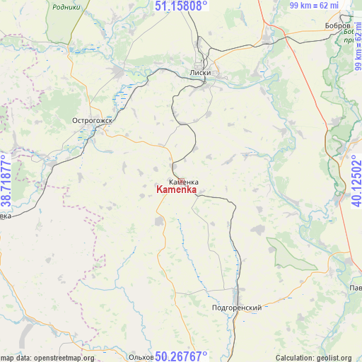
Kamenka GPS coordinates[2]
50° 42' 53.964" North, 39° 25' 18.804" East
| Map corner | latitude | longitude |
|---|---|---|
| Upper-left | 51.15808°, | 38.71877° |
| Center: | 50.71499°, | 39.42189° |
| Lower-right: | 50.26767°, | 40.12502° |
| Map W x H: | 99×99 km | = 61.5×61.5mi |
| max Lat: | 73.50819° ⇑75.9% North |
| Kamenka: | 50.71499° |
| min Lat: | ⇓24.1% South 41.28413° |
| min Long | Kamenka | max Long |
| -179.12198° | 39.42189° | 179.35046° |
| W 29.7%⇐ | ⇒70.3% E |
Elevation
Elevation of Kamenka is 232 m = 761 ft, and this is 29.4 m = 96 ft above average elevation for this country.
| Max E: |
2518 m = 8261 ft | 22.2% |
| Kamenka | 232 m 761 ft | |
| Avg. | 202.6 m = 665 ft | |
Min E: |
-28 m = -92 ft | 77.8% |
See also: Russia elevation on elevation.city.
Geographical zone
Kamenka is located in North temperate zone (between Tropic of Cancer and the Arctic Circle). Distance of this North polar circle is 1762.2 km =1095 mi to North.| Distance of | km | miles | from Kamenka |
|---|---|---|---|
| North Pole | 4368.1 | 2714.2 | to North |
| Arctic Circle | 1762.2 | 1095 | to North |
| Tropic Cancer | 3033.1 | 1884.7 | to South |
| Equator | 5639 | 3503.9 | to South |


Nearby cities:
15 places around Kamenka: (largest is in red/bold)
• Alekseyevka
52.4 km =32.6 mi,  259°
259°
• Belogor’ye
48.4 km =30.1 mi,  121°
121°
• Davydovka
49.2 km =30.6 mi,  0°
0°
• Drakino
47.2 km =29.3 mi,  358°
358°
• Imeni Pervogo Maya
22.8 km =14.2 mi,  31°
31°
• Korotoyak
34.8 km =21.6 mi,  330°
330°
• Liski
30.6 km =19 mi,  12°
12°
• Losevo
44.1 km =27.4 mi,  95°
95°
• Ol’khovatka
49 km =30.4 mi,  191°
191°
• Ostrogozhsk
29.6 km =18.4 mi,  304°
304°
• Podgorenskiy
37.8 km =23.5 mi,  155°
155°
• Podgornoye
36.1 km =22.4 mi, 157°
• Sredniy Ikorets
45.8 km =28.5 mi, 31°
• Uryv-Pokrovka
48.1 km =29.9 mi,  337°
337°
• Zabolotovka
49.2 km =30.6 mi, 188°
Sources, notices
• [Note1] Compared only with cities in Russia existing in our database
• [Src1] Map data: © OpenStreetMap contributors (CC-BY-SA)
• [Src2] Other city data from geonames.org with taken over terms of usage.
• [Src3] Geographical zone / Annual Mean Temperature by Robert A. Rohde @ Wikipedia
