Kafyr-Kumukh geodata
Kafyr-Kumukh (Dagestan) is a populated place; located in Russia in Europe/Moscow (GMT+3) time zone. With population of 4,274 people, there are 2964 cities with bigger population in this country. Compared to other cities in Russia, 98.1% of cities are located further ↑North; 56.4% of cities are located further ←West and 86.9% of cities have lower elevation than Kafyr-Kumukh. Note1


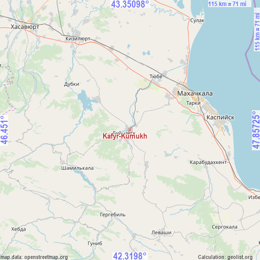
Kafyr-Kumukh GPS coordinates[2]
42° 50' 15.144" North, 47° 9' 14.832" East
| Map corner | latitude | longitude |
|---|---|---|
| Upper-left | 43.35098°, | 46.451° |
| Center: | 42.83754°, | 47.15412° |
| Lower-right: | 42.3198°, | 47.85725° |
| Map W x H: | 114.7×114.7 km | = 71.3×71.3mi |
| max Lat: | 73.50819° ⇑98.1% North |
| Kafyr-Kumukh: | 42.83754° |
| min Lat: | ⇓1.9% South 41.28413° |
| min Long | Kafyr-Kumukh | max Long |
| -179.12198° | 47.15412° | 179.35046° |
| W 56.4%⇐ | ⇒43.6% E |
Elevation
Elevation of Kafyr-Kumukh is 368 m = 1207 ft, and this is 165.4 m = 543 ft above average elevation for this country.
| Max E: |
2518 m = 8261 ft | 13.1% |
| Kafyr-Kumukh | 368 m 1207 ft | |
| Avg. | 202.6 m = 665 ft | |
Min E: |
-28 m = -92 ft | 86.9% |
See also: Russia elevation on elevation.city.
Geographical zone
Kafyr-Kumukh is located in North temperate zone (between Tropic of Cancer and the Arctic Circle). Distance of this Northern Tropic circle is 2157.2 km =1340.4 mi to South.| Distance of | km | miles | from Kafyr-Kumukh |
|---|---|---|---|
| North Pole | 5244 | 3258.5 | to North |
| Arctic Circle | 2638.1 | 1639.2 | to North |
| Tropic Cancer | 2157.2 | 1340.4 | to South |
| Equator | 4763.1 | 2959.7 | to South |


Nearby cities:
15 places around Kafyr-Kumukh: (largest is in red/bold)
• Buynaksk
3.5 km =2.2 mi,  234°
234°
• Chirkey
19.8 km =12.3 mi,  313°
313°
• Dorgeli
22.2 km =13.8 mi,  148°
148°
• Erpeli
14.8 km =9.2 mi,  256°
256°
• Gimry
27.1 km =16.8 mi,  251°
251°
• Karamakhi
25.8 km =16 mi,  160°
160°
• Korkmaskala
23.6 km =14.7 mi,  28°
28°
• Leninkent
21.8 km =13.5 mi,  47°
47°
• Nizhneye Kazanishche
8.2 km =5.1 mi,  176°
176°
• Nizhniy Dzhengutay
17 km =10.6 mi, 154°
• Paraul
19.6 km =12.2 mi,  122°
122°
• Shamkhal
28.8 km =17.9 mi, 31°
• Shamkhal-Termen
25.3 km =15.7 mi, 30°
• Tyube
26.6 km =16.5 mi, 27°
• Verkhneye Kazanishche
11.4 km =7.1 mi,  186°
186°
Sources, notices
• [Note1] Compared only with cities in Russia existing in our database
• [Src1] Map data: © OpenStreetMap contributors (CC-BY-SA)
• [Src2] Other city data from geonames.org with taken over terms of usage.
• [Src3] Geographical zone / Annual Mean Temperature by Robert A. Rohde @ Wikipedia
