Verkhneye Kazanishche geodata
Verkhneye Kazanishche (Dagestan) is a populated place; located in Russia in Europe/Moscow (GMT+3) time zone. With population of 6,444 people, there are 2143 cities with bigger population in this country. Compared to other cities in Russia, 98.4% of cities are located further ↑North; 56.4% of cities are located further ←West and 96.2% of cities have lower elevation than Verkhneye Kazanishche. Note1


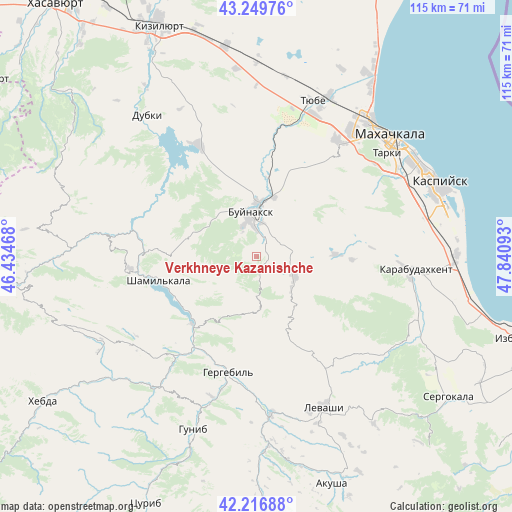
Verkhneye Kazanishche GPS coordinates[2]
42° 44' 7.692" North, 47° 8' 16.08" East
| Map corner | latitude | longitude |
|---|---|---|
| Upper-left | 43.24976°, | 46.43468° |
| Center: | 42.73547°, | 47.1378° |
| Lower-right: | 42.21688°, | 47.84093° |
| Map W x H: | 114.8×114.8 km | = 71.3×71.3mi |
| max Lat: | 73.50819° ⇑98.4% North |
| Verkhneye Kazanishche: | 42.73547° |
| min Lat: | ⇓1.6% South 41.28413° |
| min Long | Verkhneye Kazan | max Long |
| -179.12198° | 47.1378° | 179.35046° |
| W 56.4%⇐ | ⇒43.6% E |
Elevation
Elevation of Verkhneye Kazanishche is 709 m = 2326 ft, and this is 506.4 m = 1661 ft above average elevation for this country.
| Max E: |
2518 m = 8261 ft | 3.8% |
| Verkhneye Kazanishche | 709 m 2326 ft | |
| Avg. | 202.6 m = 665 ft | |
Min E: |
-28 m = -92 ft | 96.2% |
See also: Russia elevation on elevation.city.
Geographical zone
Verkhneye Kazanishche is located in North temperate zone (between Tropic of Cancer and the Arctic Circle). Distance of this Northern Tropic circle is 2145.8 km =1333.3 mi to South.| Distance of | km | miles | from Verkhneye Kazanishche |
|---|---|---|---|
| North Pole | 5255.3 | 3265.5 | to North |
| Arctic Circle | 2649.4 | 1646.3 | to North |
| Tropic Cancer | 2145.8 | 1333.3 | to South |
| Equator | 4751.7 | 2952.6 | to South |


Nearby cities:
15 places around Verkhneye Kazanishche: (largest is in red/bold)
• Buynaksk
9.4 km =5.8 mi,  350°
350°
• Chirkey
28.3 km =17.6 mi,  332°
332°
• Dorgeli
14.9 km =9.3 mi,  120°
120°
• Erpeli
15.3 km =9.5 mi,  300°
300°
• Gergebil’
26.3 km =16.3 mi,  192°
192°
• Gimry
24.5 km =15.2 mi,  276°
276°
• Irganay
21 km =13 mi,  241°
241°
• Kafyr-Kumukh
11.4 km =7.1 mi,  6°
6°
• Karamakhi
16.3 km =10.1 mi,  142°
142°
• Nizhneye Kazanishche
3.6 km =2.2 mi,  30°
30°
• Nizhniy Dzhengutay
9.6 km =6 mi,  114°
114°
• Paraul
17.8 km =11.1 mi,  87°
87°
• Shamil’kala
23 km =14.3 mi,  256°
256°
• Untsukul’
28.8 km =17.9 mi, 264°
• Urma
25 km =15.5 mi,  150°
150°
Sources, notices
• [Note1] Compared only with cities in Russia existing in our database
• [Src1] Map data: © OpenStreetMap contributors (CC-BY-SA)
• [Src2] Other city data from geonames.org with taken over terms of usage.
• [Src3] Geographical zone / Annual Mean Temperature by Robert A. Rohde @ Wikipedia
