Dorgeli geodata
Dorgeli (Dagestan) is a populated place; located in Russia in Europe/Moscow (GMT+3) time zone. With population of 5,185 people, there are 2567 cities with bigger population in this country. Compared to other cities in Russia, 98.6% of cities are located further ↑North; 56.9% of cities are located further ←West and 95.4% of cities have lower elevation than Dorgeli. Note1


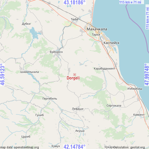
Dorgeli GPS coordinates[2]
42° 40' 1.2" North, 47° 17' 39.66" East
| Map corner | latitude | longitude |
|---|---|---|
| Upper-left | 43.18186°, | 46.59123° |
| Center: | 42.667°, | 47.29435° |
| Lower-right: | 42.14784°, | 47.99748° |
| Map W x H: | 115×115 km | = 71.5×71.5mi |
| max Lat: | 73.50819° ⇑98.6% North |
| Dorgeli: | 42.667° |
| min Lat: | ⇓1.4% South 41.28413° |
| min Long | Dorgeli | max Long |
| -179.12198° | 47.29435° | 179.35046° |
| W 56.9%⇐ | ⇒43.1% E |
Elevation
Elevation of Dorgeli is 657 m = 2156 ft, and this is 454.4 m = 1491 ft above average elevation for this country.
| Max E: |
2518 m = 8261 ft | 4.6% |
| Dorgeli | 657 m 2156 ft | |
| Avg. | 202.6 m = 665 ft | |
Min E: |
-28 m = -92 ft | 95.4% |
See also: Russia elevation on elevation.city.
Geographical zone
Dorgeli is located in North temperate zone (between Tropic of Cancer and the Arctic Circle). Distance of this Northern Tropic circle is 2138.2 km =1328.6 mi to South.| Distance of | km | miles | from Dorgeli |
|---|---|---|---|
| North Pole | 5262.9 | 3270.2 | to North |
| Arctic Circle | 2657 | 1651 | to North |
| Tropic Cancer | 2138.2 | 1328.6 | to South |
| Equator | 4744.1 | 2947.8 | to South |


Nearby cities:
15 places around Dorgeli: (largest is in red/bold)
• Buynaksk
22.1 km =13.7 mi,  319°
319°
• Erpeli
30.1 km =18.7 mi,  300°
300°
• Gergebil’
26 km =16.2 mi,  225°
225°
• Gubden
24.8 km =15.4 mi,  116°
116°
• Gurbuki
25.8 km =16 mi,  103°
103°
• Kafyr-Kumukh
22.2 km =13.8 mi,  328°
328°
• Karabudakhkent
22.8 km =14.2 mi,  78°
78°
• Karamakhi
6 km =3.7 mi,  207°
207°
• Khadzhalmakhi
29 km =18 mi,  198°
198°
• Levashi
26.4 km =16.4 mi,  175°
175°
• Nizhneye Kazanishche
15.3 km =9.5 mi,  314°
314°
• Nizhniy Dzhengutay
5.5 km =3.4 mi, 312°
• Paraul
9.7 km =6 mi,  30°
30°
• Urma
14.3 km =8.9 mi, 182°
• Verkhneye Kazanishche
14.9 km =9.3 mi, 300°
Sources, notices
• [Note1] Compared only with cities in Russia existing in our database
• [Src1] Map data: © OpenStreetMap contributors (CC-BY-SA)
• [Src2] Other city data from geonames.org with taken over terms of usage.
• [Src3] Geographical zone / Annual Mean Temperature by Robert A. Rohde @ Wikipedia
