Gryazi geodata
Gryazi (Lipetsk Oblast) is a populated place; located in Russia in Europe/Moscow (GMT+3) time zone. With population of 47,413 people, there are 447 cities with bigger population in this country. Compared to other cities in Russia, 66.2% of cities are located further ↑North; 67.8% of cities are located further →East and 60.6% of cities have higher elevation than Gryazi. Note1


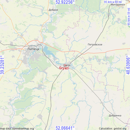
Gryazi GPS coordinates[2]
52° 29' 47.652" North, 39° 56' 9.348" East
| Map corner | latitude | longitude |
|---|---|---|
| Upper-left | 52.92256°, | 39.23281° |
| Center: | 52.49657°, | 39.93593° |
| Lower-right: | 52.06641°, | 40.63906° |
| Map W x H: | 95.2×95.2 km | = 59.2×59.2mi |
| max Lat: | 73.50819° ⇑66.2% North |
| Gryazi: | 52.49657° |
| min Lat: | ⇓33.8% South 41.28413° |
| min Long | Gryazi | max Long |
| -179.12198° | 39.93593° | 179.35046° |
| W 32.2%⇐ | ⇒67.8% E |
Elevation
Elevation of Gryazi is 123 m = 404 ft, and this is 79.6 m = 261 ft below average elevation for this country.
| Max E: |
2518 m = 8261 ft | 60.6% |
| Avg. | 202.6 m = 665 ft | |
| Gryazi | 123 m = 404 ft | |
Min E: |
-28 m = -92 ft | 39.4% |
See also: Gryazi elevation on elevation.city.
Geographical zone
Gryazi is located in North temperate zone (between Tropic of Cancer and the Arctic Circle). Distance of this North polar circle is 1564.1 km =971.9 mi to North.| Distance of | km | miles | from Gryazi |
|---|---|---|---|
| North Pole | 4170 | 2591.1 | to North |
| Arctic Circle | 1564.1 | 971.9 | to North |
| Tropic Cancer | 3231.2 | 2007.8 | to South |
| Equator | 5837.1 | 3627 | to South |


Nearby cities:
15 places around Gryazi: (largest is in red/bold)
• Bol’shoy Khomutets
32.1 km =19.9 mi,  352°
352°
• Borinskoye
38.5 km =23.9 mi,  263°
263°
• Dobrinka
51.9 km =32.2 mi,  135°
135°
• Dobroye
42.1 km =26.2 mi, 348°
• Kalikino
50.9 km =31.6 mi, 351°
• Kazinka
9 km =5.6 mi,  300°
300°
• Kuz’minskiye Otverzhki
38.5 km =23.9 mi,  305°
305°
• Lipetsk
27.4 km =17 mi, 295°
• Michurinsk
58.2 km =36.2 mi,  39°
39°
• Petrovskiy
56.1 km =34.9 mi,  120°
120°
• Plekhanovo
16.9 km =10.5 mi,  339°
339°
• Prigorodka
52.5 km =32.6 mi,  196°
196°
• Syrskoye
30.9 km =19.2 mi,  286°
286°
• Usman’
52 km =32.3 mi, 195°
• Zavoronezhskoye
59.5 km =37 mi, 44°
Sources, notices
• [Note1] Compared only with cities in Russia existing in our database
• [Src1] Map data: © OpenStreetMap contributors (CC-BY-SA)
• [Src2] Other city data from geonames.org with taken over terms of usage.
• [Src3] Geographical zone / Annual Mean Temperature by Robert A. Rohde @ Wikipedia
