Dobrinka geodata
Dobrinka (Lipetsk Oblast) is a populated place; located in Russia in Europe/Moscow (GMT+3) time zone. With population of 10,063 people, there are 1500 cities with bigger population in this country. Compared to other cities in Russia, 68.2% of cities are located further ↑North; 65.2% of cities are located further →East and 54.5% of cities have lower elevation than Dobrinka. Note1


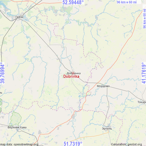
Dobrinka GPS coordinates[2]
52° 9' 55.008" North, 40° 28' 23.016" East
| Map corner | latitude | longitude |
|---|---|---|
| Upper-left | 52.59448°, | 39.76994° |
| Center: | 52.16528°, | 40.47306° |
| Lower-right: | 51.7319°, | 41.17619° |
| Map W x H: | 95.9×95.9 km | = 59.6×59.6mi |
| max Lat: | 73.50819° ⇑68.2% North |
| Dobrinka: | 52.16528° |
| min Lat: | ⇓31.8% South 41.28413° |
| min Long | Dobrinka | max Long |
| -179.12198° | 40.47306° | 179.35046° |
| W 34.8%⇐ | ⇒65.2% E |
Elevation
Elevation of Dobrinka is 155 m = 509 ft, and this is 47.6 m = 156 ft below average elevation for this country.
| Max E: |
2518 m = 8261 ft | 45.5% |
| Avg. | 202.6 m = 665 ft | |
| Dobrinka | 155 m = 509 ft | |
Min E: |
-28 m = -92 ft | 54.5% |
See also: Russia elevation on elevation.city.
Geographical zone
Dobrinka is located in North temperate zone (between Tropic of Cancer and the Arctic Circle). Distance of this North polar circle is 1600.9 km =994.8 mi to North.| Distance of | km | miles | from Dobrinka |
|---|---|---|---|
| North Pole | 4206.8 | 2614 | to North |
| Arctic Circle | 1600.9 | 994.8 | to North |
| Tropic Cancer | 3194.3 | 1984.8 | to South |
| Equator | 5800.2 | 3604.1 | to South |


Nearby cities:
15 places around Dobrinka: (largest is in red/bold)
• Ertil’
42.7 km =26.5 mi,  147°
147°
• Gryazi
51.9 km =32.2 mi,  315°
315°
• Kazinka
60.6 km =37.7 mi,  313°
313°
• Krasnolesnyy
68.3 km =42.4 mi,  242°
242°
• Mordovo
22.2 km =13.8 mi,  114°
114°
• Novopokrovka
27.9 km =17.3 mi,  97°
97°
• Panino
62.2 km =38.6 mi,  201°
201°
• Pereleshino
52.8 km =32.8 mi,  205°
205°
• Pereleshinskiy
53.6 km =33.3 mi, 200°
• Petrovskiy
14.7 km =9.1 mi,  54°
54°
• Plekhanovo
67.6 km =42 mi, 321°
• Prigorodka
53.7 km =33.4 mi,  255°
255°
• Sadovoye
70.5 km =43.8 mi,  178°
178°
• Usman’
52.5 km =32.6 mi, 255°
• Verkhnyaya Khava
51.3 km =31.9 mi,  225°
225°
Sources, notices
• [Note1] Compared only with cities in Russia existing in our database
• [Src1] Map data: © OpenStreetMap contributors (CC-BY-SA)
• [Src2] Other city data from geonames.org with taken over terms of usage.
• [Src3] Geographical zone / Annual Mean Temperature by Robert A. Rohde @ Wikipedia
