Glebovskoe geodata
Glebovskoe (Jaroslavl) is a populated place; located in Russia in Europe/Moscow (GMT+3) time zone. With population of 602 people, there are 4878 cities with bigger population in this country. Compared to other cities in Russia, 73.9% of cities are located further ↓South; 73.5% of cities are located further →East and 63.8% of cities have lower elevation than Glebovskoe. Note1


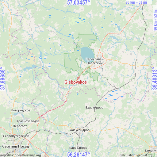
Glebovskoe GPS coordinates[2]
56° 39' 0" North, 38° 42' 0" East
| Map corner | latitude | longitude |
|---|---|---|
| Upper-left | 57.03457°, | 37.99688° |
| Center: | 56.65°, | 38.7° |
| Lower-right: | 56.26147°, | 39.40313° |
| Map W x H: | 86×86 km | = 53.4×53.4mi |
| max Lat: | 73.50819° ⇑26.1% North |
| Glebovskoe: | 56.65° |
| min Lat: | ⇓73.9% South 41.28413° |
| min Long | Glebovskoe | max Long |
| -179.12198° | 38.7° | 179.35046° |
| W 26.5%⇐ | ⇒73.5% E |
Elevation
Elevation of Glebovskoe is 179 m = 587 ft, and this is 23.6 m = 77 ft below average elevation for this country.
| Max E: |
2518 m = 8261 ft | 36.2% |
| Avg. | 202.6 m = 665 ft | |
| Glebovskoe | 179 m = 587 ft | |
Min E: |
-28 m = -92 ft | 63.8% |
See also: Russia elevation on elevation.city.
Geographical zone
Glebovskoe is located in North temperate zone (between Tropic of Cancer and the Arctic Circle). Distance of this North polar circle is 1102.3 km =684.9 mi to North.| Distance of | km | miles | from Glebovskoe |
|---|---|---|---|
| North Pole | 3708.2 | 2304.2 | to North |
| Arctic Circle | 1102.3 | 684.9 | to North |
| Tropic Cancer | 3693 | 2294.7 | to South |
| Equator | 6298.9 | 3914 | to South |


Nearby cities:
15 places around Glebovskoe: (largest is in red/bold)
• Aleksandrov
28.3 km =17.6 mi,  178°
178°
• Arsaki
32.5 km =20.2 mi,  204°
204°
• Balakirevo
18.3 km =11.4 mi,  151°
151°
• Berendeyevo
20.4 km =12.7 mi,  105°
105°
• Bogorodskoye
35.8 km =22.2 mi,  242°
242°
• Bol’shaya Brembola
17.1 km =10.6 mi,  50°
50°
• Ivanovskoye
31.5 km =19.6 mi,  39°
39°
• Karabanovo
37.1 km =23.1 mi, 180°
• Krasnozavodsk
37 km =23 mi,  233°
233°
• Mukhanovo
28.8 km =17.9 mi, 234°
• Novoye
6.9 km =4.3 mi,  216°
216°
• Pereslavl’-Zalesskiy
13.8 km =8.6 mi, 43°
• Semenkovo
36.9 km =22.9 mi, 227°
• Shemëtovo
40.6 km =25.2 mi,  250°
250°
• Strunino
31.6 km =19.6 mi,  193°
193°
Sources, notices
• [Note1] Compared only with cities in Russia existing in our database
• [Src1] Map data: © OpenStreetMap contributors (CC-BY-SA)
• [Src2] Other city data from geonames.org with taken over terms of usage.
• [Src3] Geographical zone / Annual Mean Temperature by Robert A. Rohde @ Wikipedia
