Dulyapino geodata
Dulyapino (Ivanovo) is a populated place; located in Russia in Europe/Moscow (GMT+3) time zone. With population of 1,456 people, there are 4407 cities with bigger population in this country. Compared to other cities in Russia, 78.7% of cities are located further ↓South; 63.8% of cities are located further →East and 56.2% of cities have higher elevation than Dulyapino. Note1


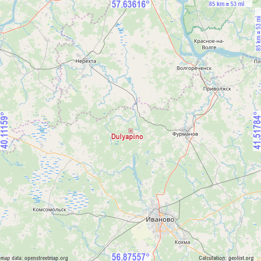
Dulyapino GPS coordinates[2]
57° 15' 28.188" North, 40° 48' 52.956" East
| Map corner | latitude | longitude |
|---|---|---|
| Upper-left | 57.63616°, | 40.11159° |
| Center: | 57.25783°, | 40.81471° |
| Lower-right: | 56.87557°, | 41.51784° |
| Map W x H: | 84.6×84.6 km | = 52.6×52.6mi |
| max Lat: | 73.50819° ⇑21.3% North |
| Dulyapino: | 57.25783° |
| min Lat: | ⇓78.7% South 41.28413° |
| min Long | Dulyapino | max Long |
| -179.12198° | 40.81471° | 179.35046° |
| W 36.2%⇐ | ⇒63.8% E |
Elevation
Elevation of Dulyapino is 132 m = 433 ft, and this is 70.6 m = 232 ft below average elevation for this country.
| Max E: |
2518 m = 8261 ft | 56.2% |
| Avg. | 202.6 m = 665 ft | |
| Dulyapino | 132 m = 433 ft | |
Min E: |
-28 m = -92 ft | 43.8% |
See also: Russia elevation on elevation.city.
Geographical zone
Dulyapino is located in North temperate zone (between Tropic of Cancer and the Arctic Circle). Distance of this North polar circle is 1034.7 km =642.9 mi to North.| Distance of | km | miles | from Dulyapino |
|---|---|---|---|
| North Pole | 3640.6 | 2262.2 | to North |
| Arctic Circle | 1034.7 | 642.9 | to North |
| Tropic Cancer | 3760.6 | 2336.7 | to South |
| Equator | 6366.5 | 3956 | to South |


Nearby cities:
15 places around Dulyapino: (largest is in red/bold)
• Bogorodskoye
26.3 km =16.3 mi,  152°
152°
• Burmakino
38.9 km =24.2 mi,  296°
296°
• Dubki
34.3 km =21.3 mi,  277°
277°
• Furmanov
17.7 km =11 mi,  91°
91°
• Ivanovo
30.5 km =19 mi,  161°
161°
• Kokhma
39.6 km =24.6 mi, 155°
• Komsomol’sk
36.8 km =22.9 mi,  226°
226°
• Kosmynino
36.2 km =22.5 mi,  355°
355°
• Krasnoye-na-Volge
38.3 km =23.8 mi,  41°
41°
• Markovo
32.9 km =20.4 mi,  215°
215°
• Nerekhta
26.6 km =16.5 mi,  327°
327°
• Novo-Talitsy
28.4 km =17.6 mi,  174°
174°
• Pistsovo
19.3 km =12 mi,  242°
242°
• Privolzhsk
31.8 km =19.8 mi,  63°
63°
• Volgorechensk
28.7 km =17.8 mi,  45°
45°
Sources, notices
• [Note1] Compared only with cities in Russia existing in our database
• [Src1] Map data: © OpenStreetMap contributors (CC-BY-SA)
• [Src2] Other city data from geonames.org with taken over terms of usage.
• [Src3] Geographical zone / Annual Mean Temperature by Robert A. Rohde @ Wikipedia
