Chërnaya Kholunitsa geodata
Chërnaya Kholunitsa (Kirov) is a populated place; located in Russia in Europe/Kirov (GMT+3) time zone. With population of 1,539 people, there are 4358 cities with bigger population in this country. Compared to other cities in Russia, 86.1% of cities are located further ↓South; 63.6% of cities are located further ←West and 67.7% of cities have lower elevation than Chërnaya Kholunitsa. Note1


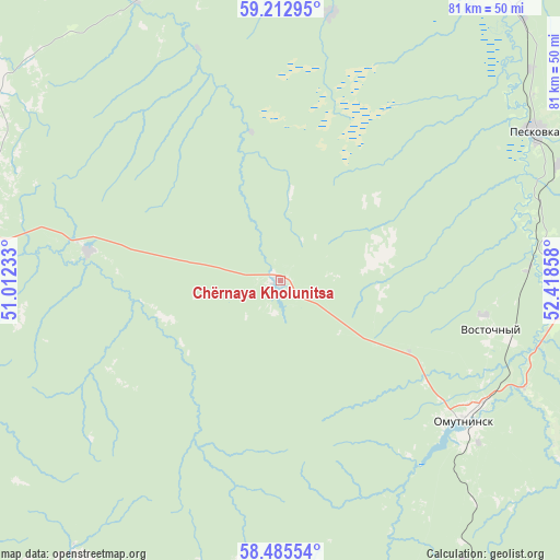
Chërnaya Kholunitsa GPS coordinates[2]
58° 51' 4.14" North, 51° 42' 55.62" East
| Map corner | latitude | longitude |
|---|---|---|
| Upper-left | 59.21295°, | 51.01233° |
| Center: | 58.85115°, | 51.71545° |
| Lower-right: | 58.48554°, | 52.41858° |
| Map W x H: | 80.9×80.9 km | = 50.3×50.3mi |
| max Lat: | 73.50819° ⇑13.9% North |
| Chërnaya Kholunitsa: | 58.85115° |
| min Lat: | ⇓86.1% South 41.28413° |
| min Long | Chërnaya Kholu | max Long |
| -179.12198° | 51.71545° | 179.35046° |
| W 63.6%⇐ | ⇒36.4% E |
Elevation
Elevation of Chërnaya Kholunitsa is 190 m = 623 ft, and this is 12.6 m = 41 ft below average elevation for this country.
| Max E: |
2518 m = 8261 ft | 32.3% |
| Avg. | 202.6 m = 665 ft | |
| Chërnaya Kholunitsa | 190 m = 623 ft | |
Min E: |
-28 m = -92 ft | 67.7% |
See also: Russia elevation on elevation.city.
Geographical zone
Chërnaya Kholunitsa is located in North temperate zone (between Tropic of Cancer and the Arctic Circle). Distance of this North polar circle is 857.5 km =532.8 mi to North.| Distance of | km | miles | from Chërnaya Kholunitsa |
|---|---|---|---|
| North Pole | 3463.4 | 2152.1 | to North |
| Arctic Circle | 857.5 | 532.8 | to North |
| Tropic Cancer | 3937.7 | 2446.8 | to South |
| Equator | 6543.6 | 4066 | to South |


Nearby cities:
15 places around Chërnaya Kholunitsa: (largest is in red/bold)
• Belaya Kholunitsa
49.6 km =30.8 mi,  268°
268°
• Belorechensk
34.4 km =21.4 mi,  104°
104°
• Dubrovka
52.8 km =32.8 mi,  322°
322°
• Falënki
54.9 km =34.1 mi,  187°
187°
• Kirs
62.1 km =38.6 mi,  29°
29°
• Kosino
54.9 km =34.1 mi,  207°
207°
• Lesnyye Polyany
43.7 km =27.2 mi,  67°
67°
• Nagorsk
73.3 km =45.5 mi,  314°
314°
• Omutninsk
34.1 km =21.2 mi,  126°
126°
• Peskovka
42.8 km =26.6 mi,  59°
59°
• Pudem
66.2 km =41.1 mi,  156°
156°
• Svetlopolyansk
73 km =45.4 mi, 30°
• Vostochnyy
31.3 km =19.4 mi, 102°
• Yar
71 km =44.1 mi, 161°
• Zuyevka
60 km =37.3 mi, 214°
Sources, notices
• [Note1] Compared only with cities in Russia existing in our database
• [Src1] Map data: © OpenStreetMap contributors (CC-BY-SA)
• [Src2] Other city data from geonames.org with taken over terms of usage.
• [Src3] Geographical zone / Annual Mean Temperature by Robert A. Rohde @ Wikipedia
