Svetlopolyansk geodata
Svetlopolyansk (Kirov) is a populated place; located in Russia in Europe/Kirov (GMT+3) time zone. With population of 3,176 people, there are 3628 cities with bigger population in this country. Compared to other cities in Russia, 87.6% of cities are located further ↓South; 64.3% of cities are located further ←West and 63.6% of cities have lower elevation than Svetlopolyansk. Note1


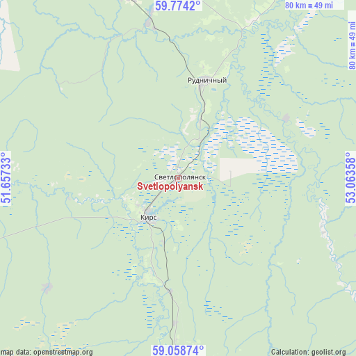
Svetlopolyansk GPS coordinates[2]
59° 25' 6.096" North, 52° 21' 37.62" East
| Map corner | latitude | longitude |
|---|---|---|
| Upper-left | 59.7742°, | 51.65733° |
| Center: | 59.41836°, | 52.36045° |
| Lower-right: | 59.05874°, | 53.06358° |
| Map W x H: | 79.6×79.5 km | = 49.5×49.4mi |
| max Lat: | 73.50819° ⇑12.4% North |
| Svetlopolyansk: | 59.41836° |
| min Lat: | ⇓87.6% South 41.28413° |
| min Long | Svetlopolyansk | max Long |
| -179.12198° | 52.36045° | 179.35046° |
| W 64.3%⇐ | ⇒35.7% E |
Elevation
Elevation of Svetlopolyansk is 178 m = 584 ft, and this is 24.6 m = 81 ft below average elevation for this country.
| Max E: |
2518 m = 8261 ft | 36.4% |
| Avg. | 202.6 m = 665 ft | |
| Svetlopolyansk | 178 m = 584 ft | |
Min E: |
-28 m = -92 ft | 63.6% |
See also: Russia elevation on elevation.city.
Geographical zone
Svetlopolyansk is located in North temperate zone (between Tropic of Cancer and the Arctic Circle). Distance of this North polar circle is 794.5 km =493.7 mi to North.| Distance of | km | miles | from Svetlopolyansk |
|---|---|---|---|
| North Pole | 3400.4 | 2112.9 | to North |
| Arctic Circle | 794.5 | 493.7 | to North |
| Tropic Cancer | 4000.8 | 2486 | to South |
| Equator | 6606.7 | 4105.2 | to South |


Nearby cities:
15 places around Svetlopolyansk: (largest is in red/bold)
• Belaya Kholunitsa
107.4 km =66.7 mi,  233°
233°
• Belorechensk
71.9 km =44.7 mi,  183°
183°
• Chërnaya Kholunitsa
73 km =45.4 mi,  210°
210°
• Dubrovka
71.5 km =44.4 mi,  252°
252°
• Kirs
11 km =6.8 mi,  216°
216°
• Kostino
76.7 km =47.7 mi,  137°
137°
• Lesnoy
42.4 km =26.3 mi,  342°
342°
• Lesnyye Polyany
46.3 km =28.8 mi, 175°
• Nagorsk
88.7 km =55.1 mi,  262°
262°
• Omutninsk
83.8 km =52.1 mi,  186°
186°
• Peskovka
41.5 km =25.8 mi, 179°
• Rudnichnyy
22.9 km =14.2 mi,  15°
15°
• Sozimskiy
36.5 km =22.7 mi,  350°
350°
• Vostochnyy
70.4 km =43.7 mi, 185°
• Yurla
111.9 km =69.5 mi,  95°
95°
Sources, notices
• [Note1] Compared only with cities in Russia existing in our database
• [Src1] Map data: © OpenStreetMap contributors (CC-BY-SA)
• [Src2] Other city data from geonames.org with taken over terms of usage.
• [Src3] Geographical zone / Annual Mean Temperature by Robert A. Rohde @ Wikipedia
