Turgenevo geodata
Turgenevo (Mordoviya Republic) is a populated place; located in Russia in Europe/Moscow (GMT+3) time zone. With population of 5,168 people, there are 2571 cities with bigger population in this country. Compared to other cities in Russia, 51.6% of cities are located further ↓South; 53.7% of cities are located further ←West and 72.2% of cities have higher elevation than Turgenevo. Note1


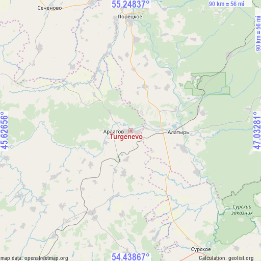
Turgenevo GPS coordinates[2]
54° 50' 43.98" North, 46° 19' 46.848" East
| Map corner | latitude | longitude |
|---|---|---|
| Upper-left | 55.24837°, | 45.62656° |
| Center: | 54.84555°, | 46.32968° |
| Lower-right: | 54.43867°, | 47.03281° |
| Map W x H: | 90×90 km | = 55.9×55.9mi |
| max Lat: | 73.50819° ⇑48.4% North |
| Turgenevo: | 54.84555° |
| min Lat: | ⇓51.6% South 41.28413° |
| min Long | Turgenevo | max Long |
| -179.12198° | 46.32968° | 179.35046° |
| W 53.7%⇐ | ⇒46.3% E |
Elevation
Elevation of Turgenevo is 97 m = 318 ft, and this is 105.6 m = 346 ft below average elevation for this country.
| Max E: |
2518 m = 8261 ft | 72.2% |
| Avg. | 202.6 m = 665 ft | |
| Turgenevo | 97 m = 318 ft | |
Min E: |
-28 m = -92 ft | 27.8% |
See also: Russia elevation on elevation.city.
Geographical zone
Turgenevo is located in North temperate zone (between Tropic of Cancer and the Arctic Circle). Distance of this North polar circle is 1302.9 km =809.6 mi to North.| Distance of | km | miles | from Turgenevo |
|---|---|---|---|
| North Pole | 3908.8 | 2428.8 | to North |
| Arctic Circle | 1302.9 | 809.6 | to North |
| Tropic Cancer | 3492.3 | 2170 | to South |
| Equator | 6098.3 | 3789.3 | to South |


Nearby cities:
15 places around Turgenevo: (largest is in red/bold)
• Alatyr’
16.1 km =10 mi,  91°
91°
• Ardatov
5.8 km =3.6 mi,  272°
272°
• Atyashevo
35.5 km =22.1 mi,  208°
208°
• Bol’shoye Boldino
67.3 km =41.8 mi,  285°
285°
• Buinsk
60.7 km =37.7 mi,  50°
50°
• Chamzinka
60.6 km =37.7 mi,  215°
215°
• Ibresi
67.8 km =42.1 mi,  41°
41°
• Kemlya
71.7 km =44.6 mi,  256°
256°
• Kirya
42.8 km =26.6 mi, 52°
• Krasnaya Gorka
61.8 km =38.4 mi,  346°
346°
• Poretskoye
39.1 km =24.3 mi,  359°
359°
• Sechenovo
50.6 km =31.4 mi,  326°
326°
• Shemursha
76.2 km =47.3 mi, 86°
• Shumerlya
73 km =45.4 mi,  4°
4°
• Surskoye
47.6 km =29.6 mi,  148°
148°
Sources, notices
• [Note1] Compared only with cities in Russia existing in our database
• [Src1] Map data: © OpenStreetMap contributors (CC-BY-SA)
• [Src2] Other city data from geonames.org with taken over terms of usage.
• [Src3] Geographical zone / Annual Mean Temperature by Robert A. Rohde @ Wikipedia
