Bogovarovo geodata
Bogovarovo (Kostroma Oblast) is a populated place; located in Russia in Europe/Moscow (GMT+3) time zone. With population of 2,327 people, there are 4026 cities with bigger population in this country. Compared to other cities in Russia, 86.4% of cities are located further ↓South; 56% of cities are located further ←West and 54.6% of cities have higher elevation than Bogovarovo. Note1


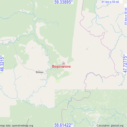
Bogovarovo GPS coordinates[2]
58° 58' 42.564" North, 47° 1' 28.632" East
| Map corner | latitude | longitude |
|---|---|---|
| Upper-left | 59.33895°, | 46.3215° |
| Center: | 58.97849°, | 47.02462° |
| Lower-right: | 58.61422°, | 47.72775° |
| Map W x H: | 80.6×80.6 km | = 50.1×50.1mi |
| max Lat: | 73.50819° ⇑13.6% North |
| Bogovarovo: | 58.97849° |
| min Lat: | ⇓86.4% South 41.28413° |
| min Long | Bogovarovo | max Long |
| -179.12198° | 47.02462° | 179.35046° |
| W 56%⇐ | ⇒44% E |
Elevation
Elevation of Bogovarovo is 135 m = 443 ft, and this is 67.6 m = 222 ft below average elevation for this country.
| Max E: |
2518 m = 8261 ft | 54.6% |
| Avg. | 202.6 m = 665 ft | |
| Bogovarovo | 135 m = 443 ft | |
Min E: |
-28 m = -92 ft | 45.4% |
See also: Russia elevation on elevation.city.
Geographical zone
Bogovarovo is located in North temperate zone (between Tropic of Cancer and the Arctic Circle). Distance of this North polar circle is 843.4 km =524.1 mi to North.| Distance of | km | miles | from Bogovarovo |
|---|---|---|---|
| North Pole | 3449.3 | 2143.3 | to North |
| Arctic Circle | 843.4 | 524.1 | to North |
| Tropic Cancer | 3951.9 | 2455.6 | to South |
| Equator | 6557.8 | 4074.8 | to South |


Nearby cities:
15 places around Bogovarovo: (largest is in red/bold)
• Darovskoy
58.4 km =36.3 mi,  113°
113°
• Kotel’nich
106.8 km =66.4 mi,  134°
134°
• Leninskoye
73.7 km =45.8 mi,  177°
177°
• Maromitsa
113.6 km =70.6 mi,  29°
29°
• Mirnyy
65 km =40.4 mi,  146°
146°
• Nikol’sk
108.5 km =67.4 mi,  304°
304°
• Pavino
52.7 km =32.7 mi,  286°
286°
• Ponazyrevo
80.3 km =49.9 mi,  210°
210°
• Pyshchug
75.9 km =47.2 mi,  262°
262°
• Shar’ya
110.5 km =68.7 mi,  232°
232°
• Svecha
82.9 km =51.5 mi,  159°
159°
• Syava
114.7 km =71.3 mi,  200°
200°
• Vakhtan
114.3 km =71 mi,  189°
189°
• Vetluzhskiy
111.3 km =69.2 mi, 234°
• Vokhma
16.2 km =10.1 mi,  250°
250°
Sources, notices
• [Note1] Compared only with cities in Russia existing in our database
• [Src1] Map data: © OpenStreetMap contributors (CC-BY-SA)
• [Src2] Other city data from geonames.org with taken over terms of usage.
• [Src3] Geographical zone / Annual Mean Temperature by Robert A. Rohde @ Wikipedia
