Vetluzhskiy geodata
Vetluzhskiy (Kostroma Oblast) is a populated place; located in Russia in Europe/Moscow (GMT+3) time zone. With population of 13,229 people, there are 1192 cities with bigger population in this country. Compared to other cities in Russia, 84.3% of cities are located further ↓South; 51.4% of cities are located further ←West and 63.9% of cities have higher elevation than Vetluzhskiy. Note1


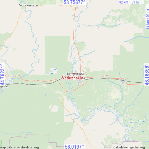
Vetluzhskiy GPS coordinates[2]
58° 23' 24.576" North, 45° 27' 55.548" East
| Map corner | latitude | longitude |
|---|---|---|
| Upper-left | 58.75677°, | 44.76231° |
| Center: | 58.39016°, | 45.46543° |
| Lower-right: | 58.0197°, | 46.16856° |
| Map W x H: | 82×82 km | = 51×51mi |
| max Lat: | 73.50819° ⇑15.7% North |
| Vetluzhskiy: | 58.39016° |
| min Lat: | ⇓84.3% South 41.28413° |
| min Long | Vetluzhskiy | max Long |
| -179.12198° | 45.46543° | 179.35046° |
| W 51.4%⇐ | ⇒48.6% E |
Elevation
Elevation of Vetluzhskiy is 116 m = 381 ft, and this is 86.6 m = 284 ft below average elevation for this country.
| Max E: |
2518 m = 8261 ft | 63.9% |
| Avg. | 202.6 m = 665 ft | |
| Vetluzhskiy | 116 m = 381 ft | |
Min E: |
-28 m = -92 ft | 36.1% |
See also: Russia elevation on elevation.city.
Geographical zone
Vetluzhskiy is located in North temperate zone (between Tropic of Cancer and the Arctic Circle). Distance of this North polar circle is 908.8 km =564.7 mi to North.| Distance of | km | miles | from Vetluzhskiy |
|---|---|---|---|
| North Pole | 3514.7 | 2183.9 | to North |
| Arctic Circle | 908.8 | 564.7 | to North |
| Tropic Cancer | 3886.5 | 2415 | to South |
| Equator | 6492.4 | 4034.2 | to South |


Nearby cities:
15 places around Vetluzhskiy: (largest is in red/bold)
• Georgiyevskoye
45.7 km =28.4 mi,  325°
325°
• Kologriv
82.4 km =51.2 mi,  306°
306°
• Leninskoye
95 km =59 mi,  94°
94°
• Manturovo
41.5 km =25.8 mi,  260°
260°
• Neya
93.8 km =58.3 mi, 263°
• Pavino
89.4 km =55.6 mi,  25°
25°
• Ponazyrevo
49.6 km =30.8 mi, 94°
• Prudy
102.5 km =63.7 mi,  152°
152°
• Pyshchug
57.1 km =35.5 mi,  14°
14°
• Shakhun’ya
104.2 km =64.7 mi,  139°
139°
• Shar’ya
3.7 km =2.3 mi,  128°
128°
• Syava
65.3 km =40.6 mi, 129°
• Vakhtan
85.8 km =53.3 mi,  123°
123°
• Vetluga
62.2 km =38.6 mi,  162°
162°
• Vokhma
95.9 km =59.6 mi,  51°
51°
Sources, notices
• [Note1] Compared only with cities in Russia existing in our database
• [Src1] Map data: © OpenStreetMap contributors (CC-BY-SA)
• [Src2] Other city data from geonames.org with taken over terms of usage.
• [Src3] Geographical zone / Annual Mean Temperature by Robert A. Rohde @ Wikipedia
