Bogorodskoye geodata
Bogorodskoye (Moscow) is a section of populated place; located in Russia in Europe/Moscow (GMT+3) time zone. With population of 103,000 people, there are 199 cities with bigger population in this country. Compared to other cities in Russia, 63.8% of cities are located further ↓South; 79.6% of cities are located further →East and 51.9% of cities have lower elevation than Bogorodskoye. Note1
Administrative division(s):
- Level 1: Moscow
- Level 2: Eastern Administrative Okrug
- Level 3: Bogorodskoye District


Bogorodskoye GPS coordinates[2]
55° 48' 48.708" North, 37° 42' 58.212" East
| Map corner | latitude | longitude |
|---|---|---|
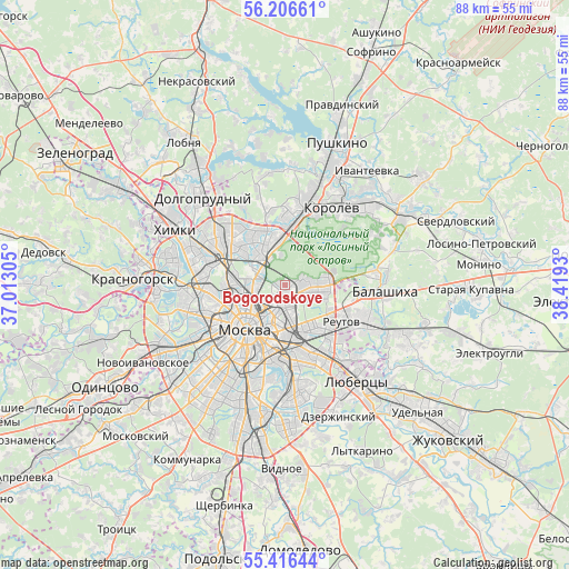
| Upper-left | 56.20661°, | 37.01305° |
| Center: | 55.81353°, | 37.71617° |
| Lower-right: | 55.41644°, | 38.4193° |
| Map W x H: | 87.9×87.9 km | = 54.6×54.6mi |
| max Lat: | 73.50819° ⇑36.2% North |
| Bogorodskoye: | 55.81353° |
| min Lat: | ⇓63.8% South 41.28413° |
| min Long | Bogorodskoye | max Long |
| -179.12198° | 37.71617° | 179.35046° |
| W 20.4%⇐ | ⇒79.6% E |
Elevation
Elevation of Bogorodskoye is 149 m = 489 ft, and this is 53.6 m = 176 ft below average elevation for this country.
| Max E: |
2518 m = 8261 ft | 48.1% |
| Avg. | 202.6 m = 665 ft | |
| Bogorodskoye | 149 m = 489 ft | |
Min E: |
-28 m = -92 ft | 51.9% |
See also: Bogorodskoye elevation on elevation.city.
Geographical zone
Bogorodskoye is located in North temperate zone (between Tropic of Cancer and the Arctic Circle). Distance of this North polar circle is 1195.3 km =742.7 mi to North.| Distance of | km | miles | from Bogorodskoye |
|---|---|---|---|
| North Pole | 3801.2 | 2362 | to North |
| Arctic Circle | 1195.3 | 742.7 | to North |
| Tropic Cancer | 3600 | 2236.9 | to South |
| Equator | 6205.9 | 3856.2 | to South |


Nearby cities:
15 places around Bogorodskoye: (largest is in red/bold)
• Babushkin
6.3 km =3.9 mi,  7°
7°
• Druzhba
8.2 km =5.1 mi, 11°
• Gol’yanovo
6.1 km =3.8 mi,  80°
80°
• Ivanovskoye
9 km =5.6 mi,  125°
125°
• Izmaylovo
6.1 km =3.8 mi,  119°
119°
• Kozeyevo
8.6 km =5.3 mi,  313°
313°
• Lefortovo
5.3 km =3.3 mi,  190°
190°
• Leonovo
5.8 km =3.6 mi, 314°
• Metrogorodok
4.5 km =2.8 mi,  95°
95°
• Ostankinskiy
6.5 km =4 mi,  285°
285°
• Rostokino
3.8 km =2.4 mi, 305°
• Sokol’niki
3.1 km =1.9 mi,  245°
245°
• Sviblovo
6.6 km =4.1 mi, 308°
• Vatutino
8 km =5 mi,  348°
348°
• Yaroslavskiy
7.8 km =4.8 mi,  0°
0°
Sources, notices
• [Note1] Compared only with cities in Russia existing in our database
• [Src1] Map data: © OpenStreetMap contributors (CC-BY-SA)
• [Src2] Other city data from geonames.org with taken over terms of usage.
• [Src3] Geographical zone / Annual Mean Temperature by Robert A. Rohde @ Wikipedia
