Pamyat’ Parizhskoy Kommuny geodata
Pamyat’ Parizhskoy Kommuny (Nizhny Novgorod Oblast) is a populated place; located in Russia in Europe/Moscow (GMT+3) time zone. With population of 4,003 people, there are 3112 cities with bigger population in this country. Compared to other cities in Russia, 68% of cities are located further ↓South; 51.6% of cities are located further →East and 77.5% of cities have higher elevation than Pamyat’ Parizhskoy Kommuny. Note1
Current local time in Pamyat’ Parizhskoy Kommuny:
05:23 PM, MondayDifference from your time zone: hours


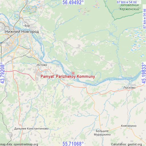
Pamyat’ Parizhskoy Kommuny GPS coordinates[2]
56° 6' 17.28" North, 44° 29' 42.72" East
| Map corner | latitude | longitude |
|---|---|---|
| Upper-left | 56.49492°, | 43.79208° |
| Center: | 56.1048°, | 44.4952° |
| Lower-right: | 55.71068°, | 45.19833° |
| Map W x H: | 87.2×87.2 km | = 54.2×54.2mi |
| max Lat: | 73.50819° ⇑32% North |
| Pamyat’ Parizhskoy Kommuny: | 56.1048° |
| min Lat: | ⇓68% South 41.28413° |
| min Long | Pamyat’ Pariz | max Long |
| -179.12198° | 44.4952° | 179.35046° |
| W 48.4%⇐ | ⇒51.6% E |
Elevation
Elevation of Pamyat’ Parizhskoy Kommuny is 79 m = 259 ft, and this is 123.6 m = 406 ft below average elevation for this country.
| Max E: |
2518 m = 8261 ft | 77.5% |
| Avg. | 202.6 m = 665 ft | |
| Pamyat’ Parizhskoy Kommuny | 79 m = 259 ft | |
Min E: |
-28 m = -92 ft | 22.5% |
See also: Russia elevation on elevation.city.
Geographical zone
Pamyat’ Parizhskoy Kommuny is located in North temperate zone (between Tropic of Cancer and the Arctic Circle). Distance of this North polar circle is 1162.9 km =722.6 mi to North.| Distance of | km | miles | from Pamyat’ Parizhskoy Kommuny |
|---|---|---|---|
| North Pole | 3768.8 | 2341.8 | to North |
| Arctic Circle | 1162.9 | 722.6 | to North |
| Tropic Cancer | 3632.3 | 2257 | to South |
| Equator | 6238.3 | 3876.3 | to South |


Nearby cities:
15 places around Pamyat’ Parizhskoy Kommuny: (largest is in red/bold)
• Afonino
30.3 km =18.8 mi,  305°
305°
• Bol’sheorlovskiy
36 km =22.4 mi,  10°
10°
• Bol’shoye Murashkino
39.8 km =24.7 mi,  154°
154°
• Bor
38.3 km =23.8 mi,  317°
317°
• Imeni M. I. Kalinina
13.1 km =8.1 mi, 309°
• Kerzhenets
40.6 km =25.2 mi,  353°
353°
• Kstovo
19 km =11.8 mi,  284°
284°
• Kuznechikha
34 km =21.1 mi,  303°
303°
• Lyakhovo
34.8 km =21.6 mi,  294°
294°
• Lyskovo
34.9 km =21.7 mi,  103°
103°
• Nizhniy Novgorod
39.4 km =24.5 mi, 309°
• Pervoye Maya
15.4 km =9.6 mi,  64°
64°
• Podnov’ye
33.5 km =20.8 mi, 311°
• Rabotki
9.7 km =6 mi,  136°
136°
• Zelyony Gorod
27.3 km =17 mi, 287°
Sources, notices
• [Note1] Compared only with cities in Russia existing in our database
• [Src1] Map data: © OpenStreetMap contributors (CC-BY-SA)
• [Src2] Other city data from geonames.org with taken over terms of usage.
• [Src3] Geographical zone / Annual Mean Temperature by Robert A. Rohde @ Wikipedia
