Vostochnyy geodata
Vostochnyy (Sverdlovsk) is a populated place; located in Russia in Asia/Yekaterinburg (GMT+5) time zone. With population of 5,635 people, there are 2388 cities with bigger population in this country. Compared to other cities in Russia, 85.9% of cities are located further ↓South; 74.3% of cities are located further ←West and 65% of cities have higher elevation than Vostochnyy. Note1


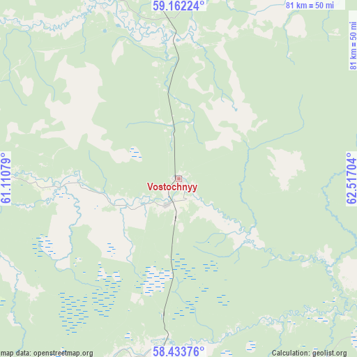
Vostochnyy GPS coordinates[2]
58° 47' 59.676" North, 61° 48' 50.076" East
| Map corner | latitude | longitude |
|---|---|---|
| Upper-left | 59.16224°, | 61.11079° |
| Center: | 58.79991°, | 61.81391° |
| Lower-right: | 58.43376°, | 62.51704° |
| Map W x H: | 81×81 km | = 50.3×50.3mi |
| max Lat: | 73.50819° ⇑14.1% North |
| Vostochnyy: | 58.79991° |
| min Lat: | ⇓85.9% South 41.28413° |
| min Long | Vostochnyy | max Long |
| -179.12198° | 61.81391° | 179.35046° |
| W 74.3%⇐ | ⇒25.7% E |
Elevation
Elevation of Vostochnyy is 114 m = 374 ft, and this is 88.6 m = 291 ft below average elevation for this country.
| Max E: |
2518 m = 8261 ft | 65% |
| Avg. | 202.6 m = 665 ft | |
| Vostochnyy | 114 m = 374 ft | |
Min E: |
-28 m = -92 ft | 35% |
See also: Russia elevation on elevation.city.
Geographical zone
Vostochnyy is located in North temperate zone (between Tropic of Cancer and the Arctic Circle). Distance of this North polar circle is 863.2 km =536.4 mi to North.| Distance of | km | miles | from Vostochnyy |
|---|---|---|---|
| North Pole | 3469.1 | 2155.6 | to North |
| Arctic Circle | 863.2 | 536.4 | to North |
| Tropic Cancer | 3932 | 2443.2 | to South |
| Equator | 6537.9 | 4062.5 | to South |


Nearby cities:
15 places around Vostochnyy: (largest is in red/bold)
• Alapayevsk
105.7 km =65.7 mi,  183°
183°
• Gari
76.5 km =47.5 mi,  23°
23°
• Karpuninskiy
9.3 km =5.8 mi,  185°
185°
• Krasnoural’sk
113.6 km =70.6 mi,  244°
244°
• Lobva
85.7 km =53.3 mi,  300°
300°
• Nizhnyaya Salda
102.5 km =63.7 mi,  218°
218°
• Nizhnyaya Sinyachikha
94.7 km =58.8 mi, 181°
• Nizhnyaya Tura
117.1 km =72.8 mi,  260°
260°
• Novaya Lyalya
75.3 km =46.8 mi,  292°
292°
• Serov
113.7 km =70.6 mi,  321°
321°
• Sos’va
42 km =26.1 mi,  3°
3°
• Verkhnyaya Salda
110.9 km =68.9 mi, 221°
• Verkhnyaya Sinyachikha
92 km =57.2 mi, 185°
• Verkhotur’ye
58.5 km =36.4 mi,  276°
276°
• Yëlkino
115 km =71.5 mi, 264°
Sources, notices
• [Note1] Compared only with cities in Russia existing in our database
• [Src1] Map data: © OpenStreetMap contributors (CC-BY-SA)
• [Src2] Other city data from geonames.org with taken over terms of usage.
• [Src3] Geographical zone / Annual Mean Temperature by Robert A. Rohde @ Wikipedia
