Tyubuk geodata
Tyubuk (Chelyabinsk) is a populated place; located in Russia in Asia/Yekaterinburg (GMT+5) time zone. With population of 3,573 people, there are 3356 cities with bigger population in this country. Compared to other cities in Russia, 67.4% of cities are located further ↓South; 73.2% of cities are located further ←West and 78.2% of cities have lower elevation than Tyubuk. Note1


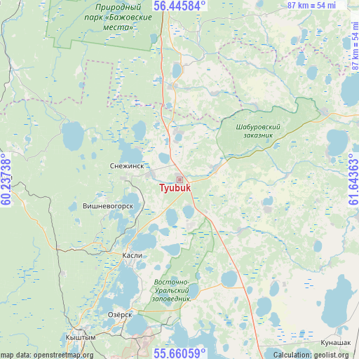
Tyubuk GPS coordinates[2]
56° 3' 18.756" North, 60° 56' 25.8" East
| Map corner | latitude | longitude |
|---|---|---|
| Upper-left | 56.44584°, | 60.23738° |
| Center: | 56.05521°, | 60.9405° |
| Lower-right: | 55.66059°, | 61.64363° |
| Map W x H: | 87.3×87.3 km | = 54.2×54.2mi |
| max Lat: | 73.50819° ⇑32.6% North |
| Tyubuk: | 56.05521° |
| min Lat: | ⇓67.4% South 41.28413° |
| min Long | Tyubuk | max Long |
| -179.12198° | 60.9405° | 179.35046° |
| W 73.2%⇐ | ⇒26.8% E |
Elevation
Elevation of Tyubuk is 236 m = 774 ft, and this is 33.4 m = 110 ft above average elevation for this country.
| Max E: |
2518 m = 8261 ft | 21.8% |
| Tyubuk | 236 m 774 ft | |
| Avg. | 202.6 m = 665 ft | |
Min E: |
-28 m = -92 ft | 78.2% |
See also: Russia elevation on elevation.city.
Geographical zone
Tyubuk is located in North temperate zone (between Tropic of Cancer and the Arctic Circle). Distance of this North polar circle is 1168.4 km =726 mi to North.| Distance of | km | miles | from Tyubuk |
|---|---|---|---|
| North Pole | 3774.3 | 2345.2 | to North |
| Arctic Circle | 1168.4 | 726 | to North |
| Tropic Cancer | 3626.8 | 2253.6 | to South |
| Equator | 6232.8 | 3872.9 | to South |


Nearby cities:
15 places around Tyubuk: (largest is in red/bold)
• Cheremshanka
42.3 km =26.3 mi,  279°
279°
• Dvurechensk
61.1 km =38 mi,  8°
8°
• Kasli
21.4 km =13.3 mi,  211°
211°
• Kunashak
54.6 km =33.9 mi,  135°
135°
• Kyshtym
45 km =28 mi, 212°
• Novogornyy
48.2 km =30 mi,  191°
191°
• Ozersk
36.5 km =22.7 mi,  203°
203°
• Shchelkun
27.6 km =17.1 mi,  1°
1°
• Snezhinsk
13.4 km =8.3 mi, 284°
• Sysert’
50.3 km =31.3 mi,  351°
351°
• Tayginka
55 km =34.2 mi, 209°
• Ust’-Bagaryak
56.9 km =35.4 mi,  81°
81°
• Verkhniy Ufaley
43.5 km =27 mi,  270°
270°
• Verkhnyaya Sysert’
44.3 km =27.5 mi, 345°
• Vishnëvogorsk
18.9 km =11.7 mi,  247°
247°
Sources, notices
• [Note1] Compared only with cities in Russia existing in our database
• [Src1] Map data: © OpenStreetMap contributors (CC-BY-SA)
• [Src2] Other city data from geonames.org with taken over terms of usage.
• [Src3] Geographical zone / Annual Mean Temperature by Robert A. Rohde @ Wikipedia
