Tayginka geodata
Tayginka (Chelyabinsk) is a populated place; located in Russia in Asia/Yekaterinburg (GMT+5) time zone. With population of 1,413 people, there are 4422 cities with bigger population in this country. Compared to other cities in Russia, 60.2% of cities are located further ↓South; 72.4% of cities are located further ←West and 81.4% of cities have lower elevation than Tayginka. Note1


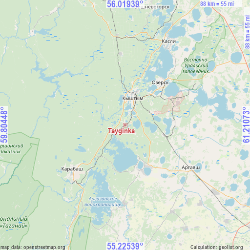
Tayginka GPS coordinates[2]
55° 37' 27.84" North, 60° 30' 27.36" East
| Map corner | latitude | longitude |
|---|---|---|
| Upper-left | 56.01939°, | 59.80448° |
| Center: | 55.6244°, | 60.5076° |
| Lower-right: | 55.22539°, | 61.21073° |
| Map W x H: | 88.3×88.3 km | = 54.9×54.9mi |
| max Lat: | 73.50819° ⇑39.8% North |
| Tayginka: | 55.6244° |
| min Lat: | ⇓60.2% South 41.28413° |
| min Long | Tayginka | max Long |
| -179.12198° | 60.5076° | 179.35046° |
| W 72.4%⇐ | ⇒27.6% E |
Elevation
Elevation of Tayginka is 265 m = 869 ft, and this is 62.4 m = 205 ft above average elevation for this country.
| Max E: |
2518 m = 8261 ft | 18.6% |
| Tayginka | 265 m 869 ft | |
| Avg. | 202.6 m = 665 ft | |
Min E: |
-28 m = -92 ft | 81.4% |
See also: Russia elevation on elevation.city.
Geographical zone
Tayginka is located in North temperate zone (between Tropic of Cancer and the Arctic Circle). Distance of this North polar circle is 1216.3 km =755.8 mi to North.| Distance of | km | miles | from Tayginka |
|---|---|---|---|
| North Pole | 3822.2 | 2375 | to North |
| Arctic Circle | 1216.3 | 755.8 | to North |
| Tropic Cancer | 3578.9 | 2223.8 | to South |
| Equator | 6184.9 | 3843.1 | to South |


Nearby cities:
15 places around Tayginka: (largest is in red/bold)
• Argayash
27.7 km =17.2 mi,  123°
123°
• Cheremshanka
57 km =35.4 mi,  344°
344°
• Karabash
24.3 km =15.1 mi,  228°
228°
• Kasli
33.6 km =20.9 mi,  28°
28°
• Kyshtym
10.4 km =6.5 mi,  15°
15°
• Nizhniy Ufaley
46 km =28.6 mi,  314°
314°
• Novogornyy
17.9 km =11.1 mi,  88°
88°
• Ozersk
19 km =11.8 mi,  39°
39°
• Roshchino
59.1 km =36.7 mi,  126°
126°
• Snezhinsk
53.1 km =33 mi, 15°
• Turgoyak
58.2 km =36.2 mi,  204°
204°
• Tyubuk
55 km =34.2 mi, 29°
• Uvil’dy
11.5 km =7.1 mi,  157°
157°
• Verkhniy Ufaley
50.8 km =31.6 mi, 340°
• Vishnëvogorsk
41.9 km =26 mi,  12°
12°
Sources, notices
• [Note1] Compared only with cities in Russia existing in our database
• [Src1] Map data: © OpenStreetMap contributors (CC-BY-SA)
• [Src2] Other city data from geonames.org with taken over terms of usage.
• [Src3] Geographical zone / Annual Mean Temperature by Robert A. Rohde @ Wikipedia
