Turinskaya Sloboda geodata
Turinskaya Sloboda (Sverdlovsk) is a populated place; located in Russia in Asia/Yekaterinburg (GMT+5) time zone. With population of 6,023 people, there are 2251 cities with bigger population in this country. Compared to other cities in Russia, 80.6% of cities are located further ↓South; 75.5% of cities are located further ←West and 81.9% of cities have higher elevation than Turinskaya Sloboda. Note1


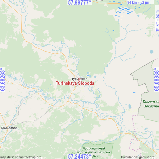
Turinskaya Sloboda GPS coordinates[2]
57° 37' 23.52" North, 64° 23' 8.7" East
| Map corner | latitude | longitude |
|---|---|---|
| Upper-left | 57.99777°, | 63.68263° |
| Center: | 57.6232°, | 64.38575° |
| Lower-right: | 57.24473°, | 65.08888° |
| Map W x H: | 83.7×83.7 km | = 52×52mi |
| max Lat: | 73.50819° ⇑19.4% North |
| Turinskaya Sloboda: | 57.6232° |
| min Lat: | ⇓80.6% South 41.28413° |
| min Long | Turinskaya Slob | max Long |
| -179.12198° | 64.38575° | 179.35046° |
| W 75.5%⇐ | ⇒24.5% E |
Elevation
Elevation of Turinskaya Sloboda is 64 m = 210 ft, and this is 138.6 m = 455 ft below average elevation for this country.
| Max E: |
2518 m = 8261 ft | 81.9% |
| Avg. | 202.6 m = 665 ft | |
| Turinskaya Sloboda | 64 m = 210 ft | |
Min E: |
-28 m = -92 ft | 18.1% |
See also: Russia elevation on elevation.city.
Geographical zone
Turinskaya Sloboda is located in North temperate zone (between Tropic of Cancer and the Arctic Circle). Distance of this North polar circle is 994.1 km =617.7 mi to North.| Distance of | km | miles | from Turinskaya Sloboda |
|---|---|---|---|
| North Pole | 3600 | 2236.9 | to North |
| Arctic Circle | 994.1 | 617.7 | to North |
| Tropic Cancer | 3801.2 | 2362 | to South |
| Equator | 6407.1 | 3981.2 | to South |


Nearby cities:
15 places around Turinskaya Sloboda: (largest is in red/bold)
• Azanka
52.1 km =32.4 mi,  27°
27°
• Baykalovo
44.6 km =27.7 mi,  235°
235°
• Irbit
78.4 km =48.7 mi,  273°
273°
• Lesnoy
77.8 km =48.3 mi, 269°
• Lugovskoy
74.4 km =46.2 mi,  173°
173°
• Melioratorov
86.4 km =53.7 mi,  122°
122°
• Moskovskiy
84.3 km =52.4 mi,  132°
132°
• Talitsa
78.6 km =48.8 mi,  209°
209°
• Tavda
70.2 km =43.6 mi,  48°
48°
• Troitskiy
73.4 km =45.6 mi, 211°
• Tugulym
64.6 km =40.1 mi, 166°
• Turinsk
62.2 km =38.6 mi,  319°
319°
• Tyumen
86.1 km =53.5 mi, 127°
• Yushala
61.3 km =38.1 mi,  187°
187°
• Zavodouspenskoye
92.7 km =57.6 mi,  155°
155°
Sources, notices
• [Note1] Compared only with cities in Russia existing in our database
• [Src1] Map data: © OpenStreetMap contributors (CC-BY-SA)
• [Src2] Other city data from geonames.org with taken over terms of usage.
• [Src3] Geographical zone / Annual Mean Temperature by Robert A. Rohde @ Wikipedia
