Tavda geodata
Tavda (Sverdlovsk) is a populated place; located in Russia in Asia/Yekaterinburg (GMT+5) time zone. With population of 39,480 people, there are 531 cities with bigger population in this country. Compared to other cities in Russia, 82.8% of cities are located further ↓South; 75.9% of cities are located further ←West and 76.3% of cities have higher elevation than Tavda. Note1


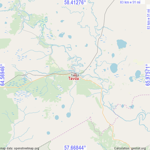
Tavda GPS coordinates[2]
58° 2' 33.144" North, 65° 16' 21.288" East
| Map corner | latitude | longitude |
|---|---|---|
| Upper-left | 58.41276°, | 64.56946° |
| Center: | 58.04254°, | 65.27258° |
| Lower-right: | 57.66844°, | 65.97571° |
| Map W x H: | 82.8×82.8 km | = 51.4×51.4mi |
| max Lat: | 73.50819° ⇑17.2% North |
| Tavda: | 58.04254° |
| min Lat: | ⇓82.8% South 41.28413° |
| min Long | Tavda | max Long |
| -179.12198° | 65.27258° | 179.35046° |
| W 75.9%⇐ | ⇒24.1% E |
Elevation
Elevation of Tavda is 83 m = 272 ft, and this is 119.6 m = 392 ft below average elevation for this country.
| Max E: |
2518 m = 8261 ft | 76.3% |
| Avg. | 202.6 m = 665 ft | |
| Tavda | 83 m = 272 ft | |
Min E: |
-28 m = -92 ft | 23.7% |
See also: Russia elevation on elevation.city.
Geographical zone
Tavda is located in North temperate zone (between Tropic of Cancer and the Arctic Circle). Distance of this North polar circle is 947.4 km =588.7 mi to North.| Distance of | km | miles | from Tavda |
|---|---|---|---|
| North Pole | 3553.3 | 2207.9 | to North |
| Arctic Circle | 947.4 | 588.7 | to North |
| Tropic Cancer | 3847.8 | 2390.9 | to South |
| Equator | 6453.7 | 4010.1 | to South |


Nearby cities:
15 places around Tavda: (largest is in red/bold)
• Antipino
108 km =67.1 mi,  164°
164°
• Azanka
28.4 km =17.6 mi,  269°
269°
• Baykalovo
114.5 km =71.1 mi,  231°
231°
• Borovskiy
114.5 km =71.1 mi,  166°
166°
• Chervishevo
122.2 km =75.9 mi,  175°
175°
• Kuminskiy
102.5 km =63.7 mi,  47°
47°
• Melioratorov
94.6 km =58.8 mi, 167°
• Moskovskiy
104 km =64.6 mi, 175°
• Nizhnyaya Tavda
67.2 km =41.8 mi,  127°
127°
• Tabory
67.8 km =42.1 mi,  321°
321°
• Tugulym
115.6 km =71.8 mi,  198°
198°
• Turinsk
92.8 km =57.7 mi, 270°
• Turinskaya Sloboda
70.2 km =43.6 mi, 228°
• Tyumen
100.2 km =62.3 mi, 171°
• Yushala
123.3 km =76.6 mi,  209°
209°
Sources, notices
• [Note1] Compared only with cities in Russia existing in our database
• [Src1] Map data: © OpenStreetMap contributors (CC-BY-SA)
• [Src2] Other city data from geonames.org with taken over terms of usage.
• [Src3] Geographical zone / Annual Mean Temperature by Robert A. Rohde @ Wikipedia
