Tatarsk geodata
Tatarsk (Novosibirsk Oblast) is a populated place; located in Russia in Asia/Novosibirsk (GMT+7) time zone. With population of 25,150 people, there are 747 cities with bigger population in this country. Compared to other cities in Russia, 55.4% of cities are located further ↓South; 78.4% of cities are located further ←West and 67.2% of cities have higher elevation than Tatarsk. Note1


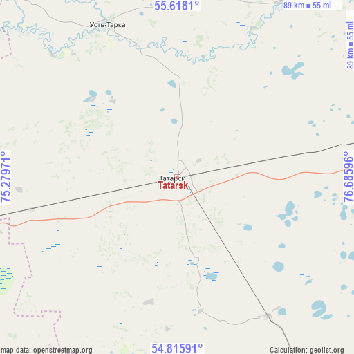
Tatarsk GPS coordinates[2]
55° 13' 8.508" North, 75° 58' 58.188" East
| Map corner | latitude | longitude |
|---|---|---|
| Upper-left | 55.6181°, | 75.27971° |
| Center: | 55.21903°, | 75.98283° |
| Lower-right: | 54.81591°, | 76.68596° |
| Map W x H: | 89.2×89.2 km | = 55.4×55.4mi |
| max Lat: | 73.50819° ⇑44.6% North |
| Tatarsk: | 55.21903° |
| min Lat: | ⇓55.4% South 41.28413° |
| min Long | Tatarsk | max Long |
| -179.12198° | 75.98283° | 179.35046° |
| W 78.4%⇐ | ⇒21.6% E |
Elevation
Elevation of Tatarsk is 109 m = 358 ft, and this is 93.6 m = 307 ft below average elevation for this country.
| Max E: |
2518 m = 8261 ft | 67.2% |
| Avg. | 202.6 m = 665 ft | |
| Tatarsk | 109 m = 358 ft | |
Min E: |
-28 m = -92 ft | 32.8% |
See also: Russia elevation on elevation.city.
Geographical zone
Tatarsk is located in North temperate zone (between Tropic of Cancer and the Arctic Circle). Distance of this North polar circle is 1261.4 km =783.8 mi to North.| Distance of | km | miles | from Tatarsk |
|---|---|---|---|
| North Pole | 3867.3 | 2403 | to North |
| Arctic Circle | 1261.4 | 783.8 | to North |
| Tropic Cancer | 3533.9 | 2195.9 | to South |
| Equator | 6139.8 | 3815.1 | to South |


Nearby cities:
15 places around Tatarsk: (largest is in red/bold)
• Barabinsk
151.1 km =93.9 mi,  84°
84°
• Bol’sherech’ye
129.1 km =80.2 mi,  318°
318°
• Chany
50.6 km =31.4 mi, 78°
• Cherlak
140.4 km =87.2 mi,  212°
212°
• Kalachinsk
91.4 km =56.8 mi,  258°
258°
• Kormilovka
122 km =75.8 mi, 258°
• Kupino
126.9 km =78.9 mi,  138°
138°
• Kuybyshev
150.1 km =93.3 mi, 80°
• Muromtsevo
136.3 km =84.7 mi,  340°
340°
• Nizhnyaya Omka
70 km =43.5 mi,  289°
289°
• Novovarshavka
142.8 km =88.7 mi,  215°
215°
• Okoneshnikovo
71.3 km =44.3 mi,  233°
233°
• Tagan
88.2 km =54.8 mi,  109°
109°
• Ust’-Tarka
42.5 km =26.4 mi, 335°
• Vengerovo
70.7 km =43.9 mi,  42°
42°
Sources, notices
• [Note1] Compared only with cities in Russia existing in our database
• [Src1] Map data: © OpenStreetMap contributors (CC-BY-SA)
• [Src2] Other city data from geonames.org with taken over terms of usage.
• [Src3] Geographical zone / Annual Mean Temperature by Robert A. Rohde @ Wikipedia
