Podgornoye geodata
Podgornoye (Tomsk Oblast) is a populated place; located in Russia in Asia/Tomsk (GMT+7) time zone. With population of 5,024 people, there are 2649 cities with bigger population in this country. Compared to other cities in Russia, 81.5% of cities are located further ↓South; 80.1% of cities are located further ←West and 72.2% of cities have higher elevation than Podgornoye. Note1


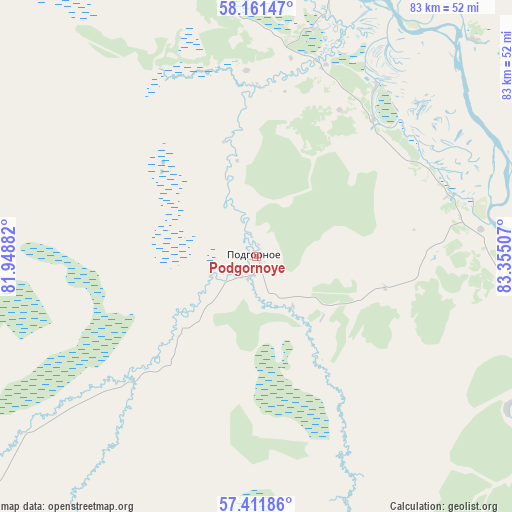
Podgornoye GPS coordinates[2]
57° 47' 18.996" North, 82° 39' 6.984" East
| Map corner | latitude | longitude |
|---|---|---|
| Upper-left | 58.16147°, | 81.94882° |
| Center: | 57.78861°, | 82.65194° |
| Lower-right: | 57.41186°, | 83.35507° |
| Map W x H: | 83.3×83.3 km | = 51.8×51.8mi |
| max Lat: | 73.50819° ⇑18.5% North |
| Podgornoye: | 57.78861° |
| min Lat: | ⇓81.5% South 41.28413° |
| min Long | Podgornoye | max Long |
| -179.12198° | 82.65194° | 179.35046° |
| W 80.1%⇐ | ⇒19.9% E |
Elevation
Elevation of Podgornoye is 97 m = 318 ft, and this is 105.6 m = 346 ft below average elevation for this country.
| Max E: |
2518 m = 8261 ft | 72.2% |
| Avg. | 202.6 m = 665 ft | |
| Podgornoye | 97 m = 318 ft | |
Min E: |
-28 m = -92 ft | 27.8% |
See also: Russia elevation on elevation.city.
Geographical zone
Podgornoye is located in North temperate zone (between Tropic of Cancer and the Arctic Circle). Distance of this North polar circle is 975.7 km =606.3 mi to North.| Distance of | km | miles | from Podgornoye |
|---|---|---|---|
| North Pole | 3581.6 | 2225.5 | to North |
| Arctic Circle | 975.7 | 606.3 | to North |
| Tropic Cancer | 3819.6 | 2373.4 | to South |
| Equator | 6425.5 | 3992.6 | to South |


Nearby cities:
15 places around Podgornoye: (largest is in red/bold)
• Bakchar
92.4 km =57.4 mi,  202°
202°
• Belyy Yar
158.2 km =98.3 mi,  62°
62°
• Kargasok
175.4 km =109 mi,  323°
323°
• Kedrovyy
188.9 km =117.4 mi,  260°
260°
• Kolpashevo
60.2 km =37.4 mi,  14°
14°
• Kozhevnikovo
187.9 km =116.8 mi,  154°
154°
• Krasnyy Yar
134.2 km =83.4 mi,  123°
123°
• Krivosheino
90.7 km =56.4 mi, 123°
• Mel’nikovo
161.8 km =100.5 mi, 147°
• Molchanovo
70.3 km =43.7 mi,  109°
109°
• Moryakovskiy Zaton
171.1 km =106.3 mi,  135°
135°
• Parabel’
122.1 km =75.9 mi,  325°
325°
• Samus’
169.4 km =105.3 mi,  133°
133°
• Seversk
188.6 km =117.2 mi, 134°
• Togur
64.7 km =40.2 mi, 9°
Sources, notices
• [Note1] Compared only with cities in Russia existing in our database
• [Src1] Map data: © OpenStreetMap contributors (CC-BY-SA)
• [Src2] Other city data from geonames.org with taken over terms of usage.
• [Src3] Geographical zone / Annual Mean Temperature by Robert A. Rohde @ Wikipedia
