Mel’nikovo geodata
Mel’nikovo (Tomsk Oblast) is a populated place; located in Russia in Asia/Tomsk (GMT+7) time zone. With population of 10,157 people, there are 1488 cities with bigger population in this country. Compared to other cities in Russia, 73.3% of cities are located further ↓South; 81.6% of cities are located further ←West and 75% of cities have higher elevation than Mel’nikovo. Note1


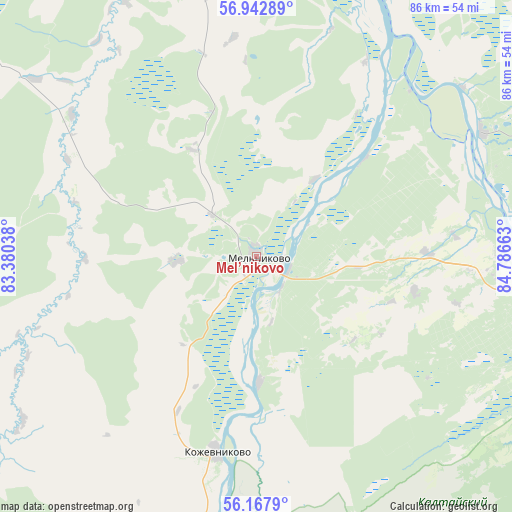
Mel’nikovo GPS coordinates[2]
56° 33' 26.568" North, 84° 5' 0.6" East
| Map corner | latitude | longitude |
|---|---|---|
| Upper-left | 56.94289°, | 83.38038° |
| Center: | 56.55738°, | 84.0835° |
| Lower-right: | 56.1679°, | 84.78663° |
| Map W x H: | 86.2×86.2 km | = 53.6×53.6mi |
| max Lat: | 73.50819° ⇑26.7% North |
| Mel’nikovo: | 56.55738° |
| min Lat: | ⇓73.3% South 41.28413° |
| min Long | Mel’nikovo | max Long |
| -179.12198° | 84.0835° | 179.35046° |
| W 81.6%⇐ | ⇒18.4% E |
Elevation
Elevation of Mel’nikovo is 88 m = 289 ft, and this is 114.6 m = 376 ft below average elevation for this country.
| Max E: |
2518 m = 8261 ft | 75% |
| Avg. | 202.6 m = 665 ft | |
| Mel’nikovo | 88 m = 289 ft | |
Min E: |
-28 m = -92 ft | 25% |
See also: Russia elevation on elevation.city.
Geographical zone
Mel’nikovo is located in North temperate zone (between Tropic of Cancer and the Arctic Circle). Distance of this North polar circle is 1112.6 km =691.3 mi to North.| Distance of | km | miles | from Mel’nikovo |
|---|---|---|---|
| North Pole | 3718.5 | 2310.6 | to North |
| Arctic Circle | 1112.6 | 691.3 | to North |
| Tropic Cancer | 3682.7 | 2288.3 | to South |
| Equator | 6288.6 | 3907.6 | to South |


Nearby cities:
15 places around Mel’nikovo: (largest is in red/bold)
• Aleksandrovskoye
82.5 km =51.3 mi,  75°
75°
• Bazoy
100.7 km =62.6 mi,  206°
206°
• Bogashevo
68.5 km =42.6 mi,  107°
107°
• Bolotnoye
100.4 km =62.4 mi,  168°
168°
• Kaltay
57.9 km =36 mi,  122°
122°
• Kozhevnikovo
33.9 km =21.1 mi,  191°
191°
• Krasnyy Yar
69 km =42.9 mi,  23°
23°
• Krivosheino
87.9 km =54.6 mi,  353°
353°
• Moryakovskiy Zaton
37.9 km =23.5 mi,  66°
66°
• Samus’
43.3 km =26.9 mi,  61°
61°
• Seversk
49.4 km =30.7 mi, 84°
• Tayga
109.6 km =68.1 mi, 120°
• Timiryazevskoye
49.3 km =30.6 mi,  98°
98°
• Tomsk
55 km =34.2 mi, 96°
• Yurga
105.3 km =65.4 mi,  151°
151°
Sources, notices
• [Note1] Compared only with cities in Russia existing in our database
• [Src1] Map data: © OpenStreetMap contributors (CC-BY-SA)
• [Src2] Other city data from geonames.org with taken over terms of usage.
• [Src3] Geographical zone / Annual Mean Temperature by Robert A. Rohde @ Wikipedia
