Kozhevnikovo geodata
Kozhevnikovo (Tomsk Oblast) is a populated place; located in Russia in Asia/Tomsk (GMT+7) time zone. With population of 7,970 people, there are 1808 cities with bigger population in this country. Compared to other cities in Russia, 70% of cities are located further ↓South; 81.5% of cities are located further ←West and 74.4% of cities have higher elevation than Kozhevnikovo. Note1


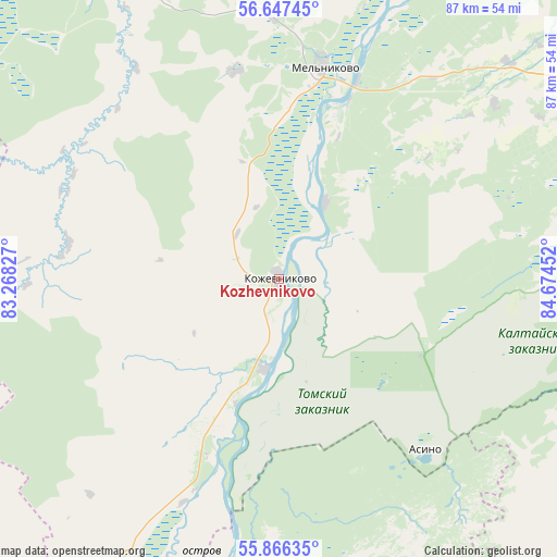
Kozhevnikovo GPS coordinates[2]
56° 15' 32.004" North, 83° 58' 17.004" East
| Map corner | latitude | longitude |
|---|---|---|
| Upper-left | 56.64745°, | 83.26827° |
| Center: | 56.25889°, | 83.97139° |
| Lower-right: | 55.86635°, | 84.67452° |
| Map W x H: | 86.9×86.8 km | = 54×53.9mi |
| max Lat: | 73.50819° ⇑30% North |
| Kozhevnikovo: | 56.25889° |
| min Lat: | ⇓70% South 41.28413° |
| min Long | Kozhevnikovo | max Long |
| -179.12198° | 83.97139° | 179.35046° |
| W 81.5%⇐ | ⇒18.5% E |
Elevation
Elevation of Kozhevnikovo is 90 m = 295 ft, and this is 112.6 m = 369 ft below average elevation for this country.
| Max E: |
2518 m = 8261 ft | 74.4% |
| Avg. | 202.6 m = 665 ft | |
| Kozhevnikovo | 90 m = 295 ft | |
Min E: |
-28 m = -92 ft | 25.6% |
See also: Russia elevation on elevation.city.
Geographical zone
Kozhevnikovo is located in North temperate zone (between Tropic of Cancer and the Arctic Circle). Distance of this North polar circle is 1145.8 km =712 mi to North.| Distance of | km | miles | from Kozhevnikovo |
|---|---|---|---|
| North Pole | 3751.7 | 2331.2 | to North |
| Arctic Circle | 1145.8 | 712 | to North |
| Tropic Cancer | 3649.5 | 2267.7 | to South |
| Equator | 6255.4 | 3886.9 | to South |


Nearby cities:
15 places around Kozhevnikovo: (largest is in red/bold)
• Bazoy
68.5 km =42.6 mi,  213°
213°
• Bogashevo
73.3 km =45.5 mi,  80°
80°
• Bolotnoye
70.5 km =43.8 mi,  157°
157°
• Dubrovino
97.3 km =60.5 mi, 205°
• Kaltay
56.1 km =34.9 mi,  87°
87°
• Mel’nikovo
33.9 km =21.1 mi,  11°
11°
• Moryakovskiy Zaton
64 km =39.8 mi,  40°
40°
• Samus’
70.3 km =43.7 mi, 39°
• Seversk
67.9 km =42.2 mi,  55°
55°
• Stantsionno-Oyashinskiy
88.6 km =55.1 mi,  185°
185°
• Tashara
87.1 km =54.1 mi,  199°
199°
• Timiryazevskoye
61.4 km =38.2 mi,  65°
65°
• Tomsk
67.2 km =41.8 mi, 66°
• Yashkino
100 km =62.1 mi,  115°
115°
• Yurga
82.4 km =51.2 mi,  136°
136°
Sources, notices
• [Note1] Compared only with cities in Russia existing in our database
• [Src1] Map data: © OpenStreetMap contributors (CC-BY-SA)
• [Src2] Other city data from geonames.org with taken over terms of usage.
• [Src3] Geographical zone / Annual Mean Temperature by Robert A. Rohde @ Wikipedia
