Nikolayevka geodata
Nikolayevka (Altai Krai) is a populated place; located in Russia in Asia/Barnaul (GMT+7) time zone. With population of 800 people, there are 4755 cities with bigger population in this country. Compared to other cities in Russia, 68.1% of cities are located further ↑North; 81.6% of cities are located further ←West and 67.7% of cities have lower elevation than Nikolayevka. Note1


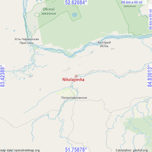
Nikolayevka GPS coordinates[2]
52° 11' 30.84" North, 84° 7' 37.2" East
| Map corner | latitude | longitude |
|---|---|---|
| Upper-left | 52.62084°, | 83.42388° |
| Center: | 52.1919°, | 84.127° |
| Lower-right: | 51.75878°, | 84.83013° |
| Map W x H: | 95.9×95.9 km | = 59.6×59.6mi |
| max Lat: | 73.50819° ⇑68.1% North |
| Nikolayevka: | 52.1919° |
| min Lat: | ⇓31.9% South 41.28413° |
| min Long | Nikolayevka | max Long |
| -179.12198° | 84.127° | 179.35046° |
| W 81.6%⇐ | ⇒18.4% E |
Elevation
Elevation of Nikolayevka is 190 m = 623 ft, and this is 12.6 m = 41 ft below average elevation for this country.
| Max E: |
2518 m = 8261 ft | 32.3% |
| Avg. | 202.6 m = 665 ft | |
| Nikolayevka | 190 m = 623 ft | |
Min E: |
-28 m = -92 ft | 67.7% |
See also: Russia elevation on elevation.city.
Geographical zone
Nikolayevka is located in North temperate zone (between Tropic of Cancer and the Arctic Circle). Distance of this North polar circle is 1598 km =993 mi to North.| Distance of | km | miles | from Nikolayevka |
|---|---|---|---|
| North Pole | 4203.9 | 2612.2 | to North |
| Arctic Circle | 1598 | 993 | to North |
| Tropic Cancer | 3197.3 | 1986.7 | to South |
| Equator | 5803.2 | 3605.9 | to South |


Nearby cities:
15 places around Nikolayevka: (largest is in red/bold)
• Anton’yevka
24.1 km =15 mi,  205°
205°
• Belokurikha
62.8 km =39 mi,  110°
110°
• Bystryy Istok
26.6 km =16.5 mi,  41°
41°
• Novopokrovka
21.3 km =13.2 mi,  80°
80°
• Novotyryshkino
54.7 km =34 mi,  102°
102°
• Pautovo
10.1 km =6.3 mi,  74°
74°
• Petropavlovskoye
13.5 km =8.4 mi,  185°
185°
• Smolenskoye
66 km =41 mi, 79°
• Sokolovo
58.8 km =36.5 mi,  49°
49°
• Soloneshnoye
61.2 km =38 mi,  167°
167°
• Starobelokurikha
67.4 km =41.9 mi, 103°
• Sychëvka
47.2 km =29.3 mi, 109°
• Ust’-Charyshskaya Pristan’
38.7 km =24 mi,  305°
305°
• Ust’-Kalmanka
56.6 km =35.2 mi,  261°
261°
• Verkh-Obskiy
65.5 km =40.7 mi, 67°
Sources, notices
• [Note1] Compared only with cities in Russia existing in our database
• [Src1] Map data: © OpenStreetMap contributors (CC-BY-SA)
• [Src2] Other city data from geonames.org with taken over terms of usage.
• [Src3] Geographical zone / Annual Mean Temperature by Robert A. Rohde @ Wikipedia
