Nazarovo geodata
Nazarovo (Krasnoyarskiy) is a populated place; located in Russia in Asia/Krasnoyarsk (GMT+7) time zone. With population of 55,252 people, there are 377 cities with bigger population in this country. Compared to other cities in Russia, 66.7% of cities are located further ↓South; 85.8% of cities are located further ←West and 80.7% of cities have lower elevation than Nazarovo. Note1


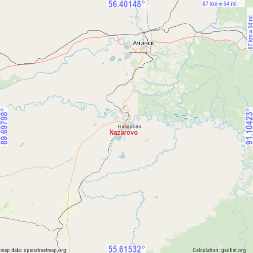
Nazarovo GPS coordinates[2]
56° 0' 37.44" North, 90° 24' 3.96" East
| Map corner | latitude | longitude |
|---|---|---|
| Upper-left | 56.40148°, | 89.69798° |
| Center: | 56.0104°, | 90.4011° |
| Lower-right: | 55.61532°, | 91.10423° |
| Map W x H: | 87.4×87.4 km | = 54.3×54.3mi |
| max Lat: | 73.50819° ⇑33.3% North |
| Nazarovo: | 56.0104° |
| min Lat: | ⇓66.7% South 41.28413° |
| min Long | Nazarovo | max Long |
| -179.12198° | 90.4011° | 179.35046° |
| W 85.8%⇐ | ⇒14.2% E |
Elevation
Elevation of Nazarovo is 253 m = 830 ft, and this is 50.4 m = 165 ft above average elevation for this country.
| Max E: |
2518 m = 8261 ft | 19.3% |
| Nazarovo | 253 m 830 ft | |
| Avg. | 202.6 m = 665 ft | |
Min E: |
-28 m = -92 ft | 80.7% |
See also: Nazarovo elevation on elevation.city.
Geographical zone
Nazarovo is located in North temperate zone (between Tropic of Cancer and the Arctic Circle). Distance of this North polar circle is 1173.4 km =729.1 mi to North.| Distance of | km | miles | from Nazarovo |
|---|---|---|---|
| North Pole | 3779.3 | 2348.3 | to North |
| Arctic Circle | 1173.4 | 729.1 | to North |
| Tropic Cancer | 3621.9 | 2250.5 | to South |
| Equator | 6227.8 | 3869.8 | to South |


Nearby cities:
15 places around Nazarovo: (largest is in red/bold)
• Achinsk
29.4 km =18.3 mi,  11°
11°
• Balakhta
103.3 km =64.2 mi,  132°
132°
• Bogotol
58.1 km =36.1 mi,  292°
292°
• Divnogorsk
122.8 km =76.3 mi,  92°
92°
• Dubinino
92.7 km =57.6 mi,  242°
242°
• Goryachegorsk
115.1 km =71.5 mi,  233°
233°
• Itatskiy
85 km =52.8 mi,  274°
274°
• Kedrovyy
76.6 km =47.6 mi,  66°
66°
• Novobirilyussy
106.2 km =66 mi, 9°
• Novochernorechenskiy
51.4 km =31.9 mi,  56°
56°
• Rassvet
128.1 km =79.6 mi,  30°
30°
• Sharypovo
91.5 km =56.9 mi, 235°
• Tyazhinskiy
117.2 km =72.8 mi,  275°
275°
• Tyukhtet
89.3 km =55.5 mi,  311°
311°
• Uzhur
85.4 km =53.1 mi,  204°
204°
Sources, notices
• [Note1] Compared only with cities in Russia existing in our database
• [Src1] Map data: © OpenStreetMap contributors (CC-BY-SA)
• [Src2] Other city data from geonames.org with taken over terms of usage.
• [Src3] Geographical zone / Annual Mean Temperature by Robert A. Rohde @ Wikipedia
