Karabash geodata
Karabash (Chelyabinsk) is a populated place; located in Russia in Asia/Yekaterinburg (GMT+5) time zone. With population of 15,630 people, there are 1054 cities with bigger population in this country. Compared to other cities in Russia, 57.9% of cities are located further ↓South; 72.1% of cities are located further ←West and 86% of cities have lower elevation than Karabash. Note1


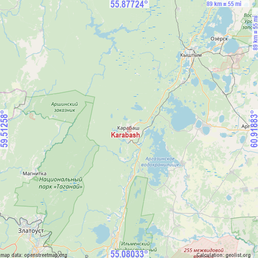
Karabash GPS coordinates[2]
55° 28' 50.88" North, 60° 12' 56.52" East
| Map corner | latitude | longitude |
|---|---|---|
| Upper-left | 55.87724°, | 59.51258° |
| Center: | 55.4808°, | 60.2157° |
| Lower-right: | 55.08033°, | 60.91883° |
| Map W x H: | 88.6×88.6 km | = 55.1×55.1mi |
| max Lat: | 73.50819° ⇑42.1% North |
| Karabash: | 55.4808° |
| min Lat: | ⇓57.9% South 41.28413° |
| min Long | Karabash | max Long |
| -179.12198° | 60.2157° | 179.35046° |
| W 72.1%⇐ | ⇒27.9% E |
Elevation
Elevation of Karabash is 347 m = 1138 ft, and this is 144.4 m = 474 ft above average elevation for this country.
| Max E: |
2518 m = 8261 ft | 14% |
| Karabash | 347 m 1138 ft | |
| Avg. | 202.6 m = 665 ft | |
Min E: |
-28 m = -92 ft | 86% |
See also: Russia elevation on elevation.city.
Geographical zone
Karabash is located in North temperate zone (between Tropic of Cancer and the Arctic Circle). Distance of this North polar circle is 1232.3 km =765.7 mi to North.| Distance of | km | miles | from Karabash |
|---|---|---|---|
| North Pole | 3838.2 | 2384.9 | to North |
| Arctic Circle | 1232.3 | 765.7 | to North |
| Tropic Cancer | 3563 | 2213.9 | to South |
| Equator | 6168.9 | 3833.2 | to South |


Nearby cities:
15 places around Karabash: (largest is in red/bold)
• Argayash
41.7 km =25.9 mi,  88°
88°
• Chebarkul’
57 km =35.4 mi,  170°
170°
• Kasli
57 km =35.4 mi,  36°
36°
• Kusa
51.4 km =31.9 mi,  252°
252°
• Kyshtym
33.5 km =20.8 mi, 39°
• Magnitka
36 km =22.4 mi, 245°
• Miass
48.9 km =30.4 mi,  187°
187°
• Nizhniy Ufaley
50.4 km =31.3 mi,  343°
343°
• Novogornyy
39.9 km =24.8 mi,  65°
65°
• Ozersk
43.2 km =26.8 mi,  45°
45°
• Syrostan
50.5 km =31.4 mi,  203°
203°
• Tayginka
24.3 km =15.1 mi, 48°
• Turgoyak
37.3 km =23.2 mi, 189°
• Uvil’dy
23.5 km =14.6 mi,  76°
76°
• Zlatoust
49.6 km =30.8 mi,  226°
226°
In other languages:
- In France: Karabach
- In German: Karabasch
- In Italian: Karabaš
- In Russian: Карабаш
- In Chinese: 卡拉巴什
Sources, notices
• [Note1] Compared only with cities in Russia existing in our database
• [Src1] Map data: © OpenStreetMap contributors (CC-BY-SA)
• [Src2] Other city data from geonames.org with taken over terms of usage.
• [Src3] Geographical zone / Annual Mean Temperature by Robert A. Rohde @ Wikipedia
