Golyshmanovo geodata
Golyshmanovo (Tyumen’ Oblast) is a populated place; located in Russia in Asia/Yekaterinburg (GMT+5) time zone. With population of 13,424 people, there are 1174 cities with bigger population in this country. Compared to other cities in Russia, 71.6% of cities are located further ↓South; 76.8% of cities are located further ←West and 61% of cities have higher elevation than Golyshmanovo. Note1


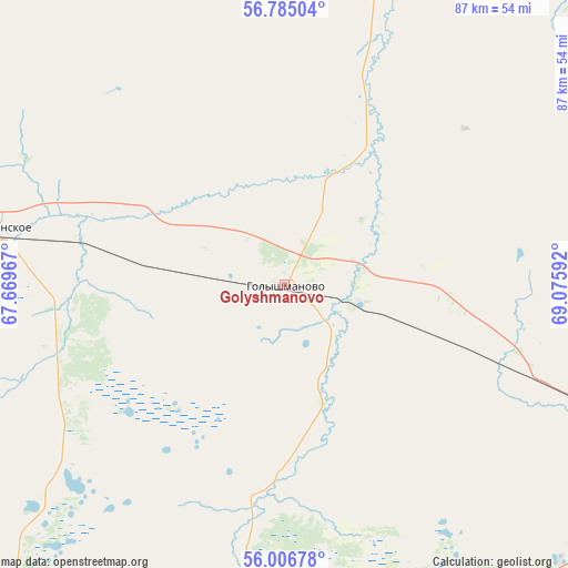
Golyshmanovo GPS coordinates[2]
56° 23' 52.44" North, 68° 22' 22.044" East
| Map corner | latitude | longitude |
|---|---|---|
| Upper-left | 56.78504°, | 67.66967° |
| Center: | 56.3979°, | 68.37279° |
| Lower-right: | 56.00678°, | 69.07592° |
| Map W x H: | 86.5×86.5 km | = 53.7×53.7mi |
| max Lat: | 73.50819° ⇑28.4% North |
| Golyshmanovo: | 56.3979° |
| min Lat: | ⇓71.6% South 41.28413° |
| min Long | Golyshmanovo | max Long |
| -179.12198° | 68.37279° | 179.35046° |
| W 76.8%⇐ | ⇒23.2% E |
Elevation
Elevation of Golyshmanovo is 122 m = 400 ft, and this is 80.6 m = 264 ft below average elevation for this country.
| Max E: |
2518 m = 8261 ft | 61% |
| Avg. | 202.6 m = 665 ft | |
| Golyshmanovo | 122 m = 400 ft | |
Min E: |
-28 m = -92 ft | 39% |
See also: Russia elevation on elevation.city.
Geographical zone
Golyshmanovo is located in North temperate zone (between Tropic of Cancer and the Arctic Circle). Distance of this North polar circle is 1130.3 km =702.3 mi to North.| Distance of | km | miles | from Golyshmanovo |
|---|---|---|---|
| North Pole | 3736.2 | 2321.6 | to North |
| Arctic Circle | 1130.3 | 702.3 | to North |
| Tropic Cancer | 3664.9 | 2277.3 | to South |
| Equator | 6270.9 | 3896.6 | to South |


Nearby cities:
15 places around Golyshmanovo: (largest is in red/bold)
• Abatskoye
128.9 km =80.1 mi,  95°
95°
• Armizonskoye
66.3 km =41.2 mi,  220°
220°
• Aromashevo
53.9 km =33.5 mi,  17°
17°
• Ishim
75.9 km =47.2 mi,  114°
114°
• Kazanskoye
99.4 km =61.8 mi,  147°
147°
• Mokrousovo
119.2 km =74.1 mi,  236°
236°
• Novaya Zaimka
89.6 km =55.7 mi,  276°
276°
• Novoseleznëvo
94.9 km =59 mi, 146°
• Omutinskiy
44 km =27.3 mi, 281°
• Uporovo
129.9 km =80.7 mi,  265°
265°
• Uspenka
68.9 km =42.8 mi,  49°
49°
• Yalutorovsk
130.2 km =80.9 mi, 282°
• Yarkovo
137.2 km =85.3 mi,  324°
324°
• Yurginskoye
76.1 km =47.3 mi,  307°
307°
• Zavodoukovsk
112.5 km =69.9 mi, 276°
Sources, notices
• [Note1] Compared only with cities in Russia existing in our database
• [Src1] Map data: © OpenStreetMap contributors (CC-BY-SA)
• [Src2] Other city data from geonames.org with taken over terms of usage.
• [Src3] Geographical zone / Annual Mean Temperature by Robert A. Rohde @ Wikipedia
