Abatskoye geodata
Abatskoye (Tyumen’ Oblast) is a populated place; located in Russia in Asia/Yekaterinburg (GMT+5) time zone. With population of 8,195 people, there are 1770 cities with bigger population in this country. Compared to other cities in Russia, 70.5% of cities are located further ↓South; 77.1% of cities are located further ←West and 78.7% of cities have higher elevation than Abatskoye. Note1


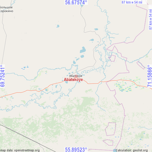
Abatskoye GPS coordinates[2]
56° 17' 14.928" North, 70° 27' 19.908" East
| Map corner | latitude | longitude |
|---|---|---|
| Upper-left | 56.67574°, | 69.75241° |
| Center: | 56.28748°, | 70.45553° |
| Lower-right: | 55.89523°, | 71.15866° |
| Map W x H: | 86.8×86.8 km | = 53.9×53.9mi |
| max Lat: | 73.50819° ⇑29.5% North |
| Abatskoye: | 56.28748° |
| min Lat: | ⇓70.5% South 41.28413° |
| min Long | Abatskoye | max Long |
| -179.12198° | 70.45553° | 179.35046° |
| W 77.1%⇐ | ⇒22.9% E |
Elevation
Elevation of Abatskoye is 75 m = 246 ft, and this is 127.6 m = 419 ft below average elevation for this country.
| Max E: |
2518 m = 8261 ft | 78.7% |
| Avg. | 202.6 m = 665 ft | |
| Abatskoye | 75 m = 246 ft | |
Min E: |
-28 m = -92 ft | 21.3% |
See also: Russia elevation on elevation.city.
Geographical zone
Abatskoye is located in North temperate zone (between Tropic of Cancer and the Arctic Circle). Distance of this North polar circle is 1142.6 km =710 mi to North.| Distance of | km | miles | from Abatskoye |
|---|---|---|---|
| North Pole | 3748.5 | 2329.2 | to North |
| Arctic Circle | 1142.6 | 710 | to North |
| Tropic Cancer | 3652.7 | 2269.7 | to South |
| Equator | 6258.6 | 3888.9 | to South |


Nearby cities:
15 places around Abatskoye: (largest is in red/bold)
• Aromashevo
128.3 km =79.7 mi,  299°
299°
• Golyshmanovo
128.9 km =80.1 mi,  275°
275°
• Ishim
62.8 km =39 mi,  251°
251°
• Kazanskoye
104.3 km =64.8 mi,  226°
226°
• Krutinka
72.5 km =45 mi,  115°
115°
• Nazyvayevsk
97.4 km =60.5 mi,  144°
144°
• Novoseleznëvo
102.8 km =63.9 mi, 229°
• Omutinskiy
172.7 km =107.3 mi, 276°
• Rostovka
134.5 km =83.6 mi, 138°
• Sladkovo
84.7 km =52.6 mi,  184°
184°
• Troitsk
128.4 km =79.8 mi, 120°
• Tyukalinsk
117.4 km =72.9 mi,  113°
113°
• Uspenka
94.5 km =58.7 mi,  307°
307°
• Ust’-Ishim
162.2 km =100.8 mi,  15°
15°
• Vikulovo
59.6 km =37 mi,  9°
9°
Sources, notices
• [Note1] Compared only with cities in Russia existing in our database
• [Src1] Map data: © OpenStreetMap contributors (CC-BY-SA)
• [Src2] Other city data from geonames.org with taken over terms of usage.
• [Src3] Geographical zone / Annual Mean Temperature by Robert A. Rohde @ Wikipedia
