Marieberg geodata
Marieberg (Uppsala) is a populated place; located in Sweden in Europe/Stockholm (GMT+2) time zone. With population of 1,181 people, there are 750 cities with bigger population in this country. Compared to other cities in Sweden, 76.3% of cities are located further ↓South; 90.9% of cities are located further ←West and 82.7% of cities have higher elevation than Marieberg. Note1


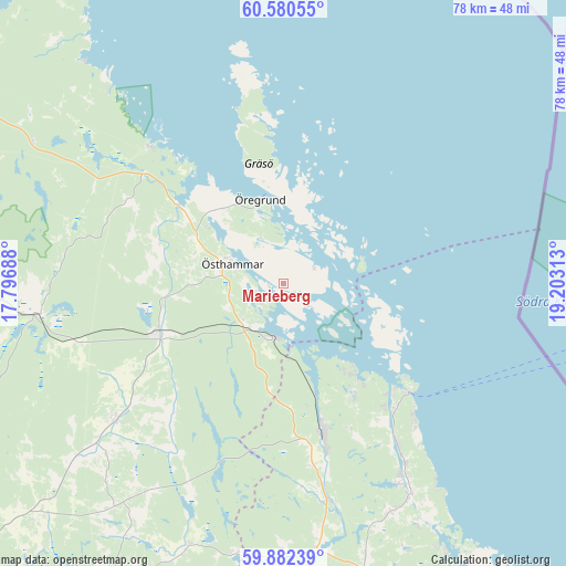
Marieberg GPS coordinates[2]
60° 13' 59.988" North, 18° 30' 0" East
| Map corner | latitude | longitude |
|---|---|---|
| Upper-left | 60.58055°, | 17.79688° |
| Center: | 60.23333°, | 18.5° |
| Lower-right: | 59.88239°, | 19.20313° |
| Map W x H: | 77.6×77.6 km | = 48.2×48.2mi |
| max Lat: | 67.85572° ⇑23.7% North |
| Marieberg: | 60.23333° |
| min Lat: | ⇓76.3% South 55.34337° |
| min Long | Marieberg | max Long |
| 11.1712° | 18.5° | 24.13676° |
| W 90.9%⇐ | ⇒9.1% E |
Elevation
Elevation of Marieberg is 14 m = 46 ft, and this is 68.6 m = 225 ft below average elevation for this country.
| Max E: |
663 m = 2175 ft | 82.7% |
| Avg. | 82.6 m = 271 ft | |
| Marieberg | 14 m = 46 ft | |
Min E: |
-1 m = -3 ft | 17.3% |
See also: Sweden elevation on elevation.city.
Geographical zone
Marieberg is located in North temperate zone (between Tropic of Cancer and the Arctic Circle). Distance of this North polar circle is 703.9 km =437.4 mi to North.| Distance of | km | miles | from Marieberg |
|---|---|---|---|
| North Pole | 3309.7 | 2056.6 | to North |
| Arctic Circle | 703.9 | 437.4 | to North |
| Tropic Cancer | 4091.4 | 2542.3 | to South |
| Equator | 6697.3 | 4161.5 | to South |


Nearby cities:
15 places around Marieberg: (largest is in red/bold)
• Alunda
6.6 km =4.1 mi,  303°
303°
• Alunda
29.6 km =18.4 mi,  231°
231°
• Anneberg
4.7 km =2.9 mi,  281°
281°
• Arnö
14.9 km =9.3 mi,  150°
150°
• Boda
6.7 km =4.2 mi,  286°
286°
• Edsbro
37.8 km =23.5 mi,  180°
180°
• Gimo
18.6 km =11.6 mi,  248°
248°
• Hallstavik
21.1 km =13.1 mi,  164°
164°
• Knutby
38.4 km =23.9 mi,  199°
199°
• Rörvik
43.2 km =26.8 mi, 149°
• Skänninge
33.4 km =20.8 mi, 181°
• Älmsta
34 km =21.1 mi, 150°
• Öregrund
11.7 km =7.3 mi,  341°
341°
• Österbybruk
33.3 km =20.7 mi,  263°
263°
• Östhammar
7.5 km =4.7 mi, 292°
Sources, notices
• [Note1] Compared only with cities in Sweden existing in our database
• [Src1] Map data: © OpenStreetMap contributors (CC-BY-SA)
• [Src2] Other city data from geonames.org with taken over terms of usage.
• [Src3] Geographical zone / Annual Mean Temperature by Robert A. Rohde @ Wikipedia
