Vellinge geodata
Vellinge (Skåne) is a seat of a second-order administrative division; located in Sweden in Europe/Stockholm (GMT+2) time zone. With population of 6,496 people, there are 219 cities with bigger population in this country. Compared to other cities in Sweden, 98.6% of cities are located further ↑North; 79.2% of cities are located further →East and 84.8% of cities have higher elevation than Vellinge. Note1


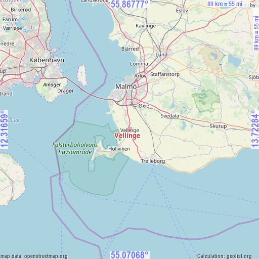
Vellinge GPS coordinates[2]
55° 28' 16.464" North, 13° 1' 10.956" East
| Map corner | latitude | longitude |
|---|---|---|
| Upper-left | 55.86777°, | 12.31659° |
| Center: | 55.47124°, | 13.01971° |
| Lower-right: | 55.07068°, | 13.72284° |
| Map W x H: | 88.6×88.6 km | = 55.1×55.1mi |
| max Lat: | 67.85572° ⇑98.6% North |
| Vellinge: | 55.47124° |
| min Lat: | ⇓1.4% South 55.34337° |
| min Long | Vellinge | max Long |
| 11.1712° | 13.01971° | 24.13676° |
| W 20.8%⇐ | ⇒79.2% E |
Elevation
Elevation of Vellinge is 13 m = 43 ft, and this is 69.6 m = 228 ft below average elevation for this country.
| Max E: |
663 m = 2175 ft | 84.8% |
| Avg. | 82.6 m = 271 ft | |
| Vellinge | 13 m = 43 ft | |
Min E: |
-1 m = -3 ft | 15.2% |
See also: Sweden elevation on elevation.city.
Geographical zone
Vellinge is located in North temperate zone (between Tropic of Cancer and the Arctic Circle). Distance of this North polar circle is 1233.4 km =766.4 mi to North.| Distance of | km | miles | from Vellinge |
|---|---|---|---|
| North Pole | 3839.2 | 2385.6 | to North |
| Arctic Circle | 1233.4 | 766.4 | to North |
| Tropic Cancer | 3561.9 | 2213.3 | to South |
| Equator | 6167.8 | 3832.5 | to South |


Nearby cities:
15 places around Vellinge: (largest is in red/bold)
• Bunkeflostrand
10.2 km =6.3 mi,  323°
323°
• Gessie Villastad
5 km =3.1 mi,  309°
309°
• Hököpinge
2.7 km =1.7 mi,  343°
343°
• Höllviken
7.9 km =4.9 mi,  210°
210°
• Kurland
11.4 km =7.1 mi,  159°
159°
• Ljunghusen
10.1 km =6.3 mi,  216°
216°
• Oxie
9 km =5.6 mi,  32°
32°
• Skanör med Falsterbo
13.3 km =8.3 mi,  233°
233°
• Skegrie
8.1 km =5 mi,  153°
153°
• Skåre
10 km =6.2 mi,  168°
168°
• Trelleborg
13.8 km =8.6 mi,  140°
140°
• Tygelsjö
5.2 km =3.2 mi,  346°
346°
• Vintrie
9.4 km =5.8 mi, 339°
• Västra Ingelstad
6.2 km =3.9 mi,  69°
69°
• Östra Grevie
7.2 km =4.5 mi,  94°
94°
Sources, notices
• [Note1] Compared only with cities in Sweden existing in our database
• [Src1] Map data: © OpenStreetMap contributors (CC-BY-SA)
• [Src2] Other city data from geonames.org with taken over terms of usage.
• [Src3] Geographical zone / Annual Mean Temperature by Robert A. Rohde @ Wikipedia
