Uppsala geodata
Uppsala is a seat of a first-order administrative division; located in Sweden in Europe/Stockholm (GMT+2) time zone. With population of 149,245 people, there are 3 cities with bigger population in this country. Compared to other cities in Sweden, 71.8% of cities are located further ↓South; 81% of cities are located further ←West and 75.3% of cities have higher elevation than Uppsala. Note1
Administrative division(s):
- Level 1: Uppsala
- Level 2: Uppsala Kommun
- Level 3: Uppsala domkyrkoförs.
- Level 4: Uppsala socken


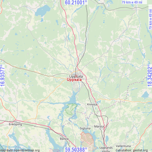
Uppsala GPS coordinates[2]
59° 51' 31.752" North, 17° 38' 20.004" East
| Map corner | latitude | longitude |
|---|---|---|
| Upper-left | 60.21001°, | 16.93577° |
| Center: | 59.85882°, | 17.63889° |
| Lower-right: | 59.50388°, | 18.34202° |
| Map W x H: | 78.5×78.5 km | = 48.8×48.8mi |
| max Lat: | 67.85572° ⇑28.2% North |
| Uppsala: | 59.85882° |
| min Lat: | ⇓71.8% South 55.34337° |
| min Long | Uppsala | max Long |
| 11.1712° | 17.63889° | 24.13676° |
| W 81%⇐ | ⇒19% E |
Elevation
Elevation of Uppsala is 20 m = 66 ft, and this is 62.6 m = 205 ft below average elevation for this country.
| Max E: |
663 m = 2175 ft | 75.3% |
| Avg. | 82.6 m = 271 ft | |
| Uppsala | 20 m = 66 ft | |
Min E: |
-1 m = -3 ft | 24.7% |
See also: Uppsala elevation on elevation.city.
Geographical zone
Uppsala is located in North temperate zone (between Tropic of Cancer and the Arctic Circle). Distance of this North polar circle is 745.5 km =463.2 mi to North.| Distance of | km | miles | from Uppsala |
|---|---|---|---|
| North Pole | 3351.4 | 2082.5 | to North |
| Arctic Circle | 745.5 | 463.2 | to North |
| Tropic Cancer | 4049.8 | 2516.4 | to South |
| Equator | 6655.7 | 4135.7 | to South |


Nearby cities:
15 places around Uppsala: (largest is in red/bold)
• Almunge
23.1 km =14.4 mi,  83°
83°
• Alsike
13.9 km =8.6 mi,  147°
147°
• Björklinge
19.6 km =12.2 mi,  345°
345°
• Bälinge
11.7 km =7.3 mi,  329°
329°
• Gamla Uppsala
4.4 km =2.7 mi,  356°
356°
• Gunsta
10.9 km =6.8 mi,  95°
95°
• Gåvsta
16.3 km =10.1 mi,  54°
54°
• Hagby
16.6 km =10.3 mi,  246°
246°
• Knivsta
17 km =10.6 mi, 150°
• Länna
17.5 km =10.9 mi,  85°
85°
• Lövstalöt
11.5 km =7.1 mi,  342°
342°
• Storvreta
11.8 km =7.3 mi,  18°
18°
• Sävja
5.6 km =3.5 mi,  142°
142°
• Vattholma
18.3 km =11.4 mi, 16°
• Ytternäs
8.7 km =5.4 mi,  194°
194°
Sources, notices
• [Note1] Compared only with cities in Sweden existing in our database
• [Src1] Map data: © OpenStreetMap contributors (CC-BY-SA)
• [Src2] Other city data from geonames.org with taken over terms of usage.
• [Src3] Geographical zone / Annual Mean Temperature by Robert A. Rohde @ Wikipedia
