Sävja geodata
Sävja (Uppsala) is a populated place; located in Sweden in Europe/Stockholm (GMT+2) time zone. With population of 9,723 people, there are 155 cities with bigger population in this country. Compared to other cities in Sweden, 71.3% of cities are located further ↓South; 81.4% of cities are located further ←West and 59.7% of cities have higher elevation than Sävja. Note1
Administrative division(s):
- Level 1: Uppsala
- Level 2: Uppsala Kommun
- Level 3: Danmark
- Level 4: Danmark socken


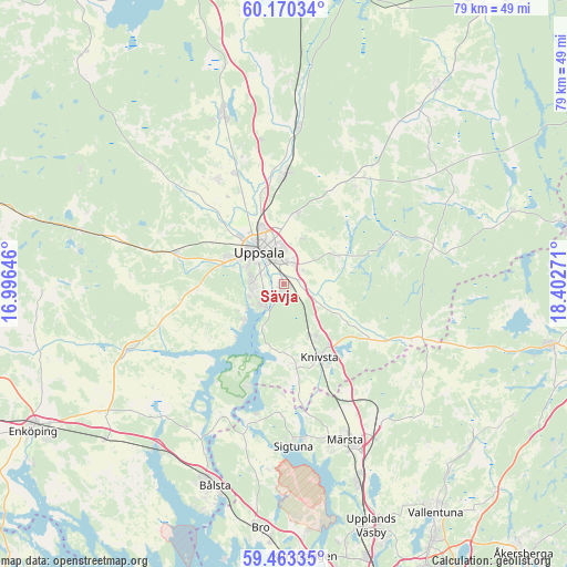
Sävja GPS coordinates[2]
59° 49' 7.392" North, 17° 41' 58.488" East
| Map corner | latitude | longitude |
|---|---|---|
| Upper-left | 60.17034°, | 16.99646° |
| Center: | 59.81872°, | 17.69958° |
| Lower-right: | 59.46335°, | 18.40271° |
| Map W x H: | 78.6×78.6 km | = 48.8×48.8mi |
| max Lat: | 67.85572° ⇑28.7% North |
| Sävja: | 59.81872° |
| min Lat: | ⇓71.3% South 55.34337° |
| min Long | Sävja | max Long |
| 11.1712° | 17.69958° | 24.13676° |
| W 81.4%⇐ | ⇒18.6% E |
Elevation
Elevation of Sävja is 36 m = 118 ft, and this is 46.6 m = 153 ft below average elevation for this country.
| Max E: |
663 m = 2175 ft | 59.7% |
| Avg. | 82.6 m = 271 ft | |
| Sävja | 36 m = 118 ft | |
Min E: |
-1 m = -3 ft | 40.3% |
See also: Sweden elevation on elevation.city.
Geographical zone
Sävja is located in North temperate zone (between Tropic of Cancer and the Arctic Circle). Distance of this North polar circle is 750 km =466 mi to North.| Distance of | km | miles | from Sävja |
|---|---|---|---|
| North Pole | 3355.8 | 2085.2 | to North |
| Arctic Circle | 750 | 466 | to North |
| Tropic Cancer | 4045.3 | 2513.6 | to South |
| Equator | 6651.2 | 4132.9 | to South |


Nearby cities:
15 places around Sävja: (largest is in red/bold)
• Almunge
20.8 km =12.9 mi,  69°
69°
• Alsike
8.4 km =5.2 mi,  150°
150°
• Bälinge
17.3 km =10.7 mi,  327°
327°
• Gamla Uppsala
9.6 km =6 mi,  337°
337°
• Gunsta
8.2 km =5.1 mi, 65°
• Gåvsta
17 km =10.6 mi,  35°
35°
• Hagby
18.7 km =11.6 mi,  263°
263°
• Knivsta
11.5 km =7.1 mi, 154°
• Länna
15.2 km =9.4 mi, 67°
• Lövstalöt
16.8 km =10.4 mi, 336°
• Sigtuna
22.4 km =13.9 mi,  176°
176°
• Storvreta
15.6 km =9.7 mi,  1°
1°
• Uppsala
5.6 km =3.5 mi,  322°
322°
• Vattholma
22.1 km =13.7 mi, 4°
• Ytternäs
6.8 km =4.2 mi,  234°
234°
Sources, notices
• [Note1] Compared only with cities in Sweden existing in our database
• [Src1] Map data: © OpenStreetMap contributors (CC-BY-SA)
• [Src2] Other city data from geonames.org with taken over terms of usage.
• [Src3] Geographical zone / Annual Mean Temperature by Robert A. Rohde @ Wikipedia
