Trönninge geodata
Trönninge (Halland) is a populated place; located in Sweden in Europe/Stockholm (GMT+2) time zone. With population of 847 people, there are 931 cities with bigger population in this country. Compared to other cities in Sweden, 76.7% of cities are located further ↑North; 90.7% of cities are located further →East and 53.8% of cities have higher elevation than Trönninge. Note1


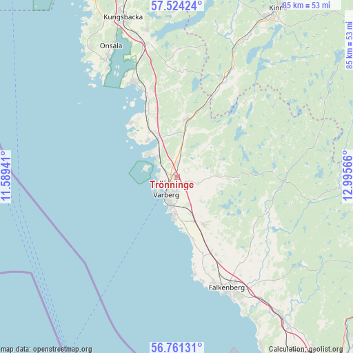
Trönninge GPS coordinates[2]
57° 8' 41.064" North, 12° 17' 33.108" East
| Map corner | latitude | longitude |
|---|---|---|
| Upper-left | 57.52424°, | 11.58941° |
| Center: | 57.14474°, | 12.29253° |
| Lower-right: | 56.76131°, | 12.99566° |
| Map W x H: | 84.8×84.8 km | = 52.7×52.7mi |
| max Lat: | 67.85572° ⇑76.7% North |
| Trönninge: | 57.14474° |
| min Lat: | ⇓23.3% South 55.34337° |
| min Long | Trönninge | max Long |
| 11.1712° | 12.29253° | 24.13676° |
| W 9.3%⇐ | ⇒90.7% E |
Elevation
Elevation of Trönninge is 44 m = 144 ft, and this is 38.6 m = 127 ft below average elevation for this country.
| Max E: |
663 m = 2175 ft | 53.8% |
| Avg. | 82.6 m = 271 ft | |
| Trönninge | 44 m = 144 ft | |
Min E: |
-1 m = -3 ft | 46.2% |
See also: Sweden elevation on elevation.city.
Geographical zone
Trönninge is located in North temperate zone (between Tropic of Cancer and the Arctic Circle). Distance of this North polar circle is 1047.3 km =650.8 mi to North.| Distance of | km | miles | from Trönninge |
|---|---|---|---|
| North Pole | 3653.2 | 2270 | to North |
| Arctic Circle | 1047.3 | 650.8 | to North |
| Tropic Cancer | 3748 | 2328.9 | to South |
| Equator | 6353.9 | 3948.1 | to South |


Nearby cities:
15 places around Trönninge: (largest is in red/bold)
• Bua
14.6 km =9.1 mi,  315°
315°
• Frillesås
20.6 km =12.8 mi,  338°
338°
• Glommen
23.8 km =14.8 mi,  171°
171°
• Långås
20.3 km =12.6 mi,  152°
152°
• Rolfstorp
9.5 km =5.9 mi,  86°
86°
• Skällinge
11.3 km =7 mi,  67°
67°
• Träslövsläge
10.1 km =6.3 mi,  184°
184°
• Trönningenäs
4.1 km =2.5 mi,  260°
260°
• Tvååker
13.2 km =8.2 mi, 150°
• Tångaberg
5.1 km =3.2 mi,  309°
309°
• Varberg
5 km =3.1 mi,  210°
210°
• Veddige
13.7 km =8.5 mi,  10°
10°
• Väröbacka
13.4 km =8.3 mi,  330°
330°
• Årnäs
8.4 km =5.2 mi, 324°
• Åsa
25.2 km =15.7 mi, 335°
Sources, notices
• [Note1] Compared only with cities in Sweden existing in our database
• [Src1] Map data: © OpenStreetMap contributors (CC-BY-SA)
• [Src2] Other city data from geonames.org with taken over terms of usage.
• [Src3] Geographical zone / Annual Mean Temperature by Robert A. Rohde @ Wikipedia
